Malabrigo geodata
Malabrigo (Santa Fe) is a populated place; located in Argentina in America/Argentina/Cordoba (GMT-3) time zone. With population of 7,026 people, there are 361 cities with bigger population in this country. Compared to other cities in Argentina, 67% of cities are located further ↓South; 68.3% of cities are located further ←West and 79.6% of cities have higher elevation than Malabrigo. Note1


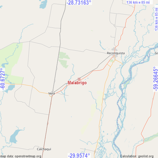
Malabrigo GPS coordinates[2]
29° 20' 46.896" South, 59° 58' 10.452" West
| Map corner | latitude | longitude |
|---|---|---|
| Upper-left | -28.73163°, | -60.6727° |
| Center: | -29.34636°, | -59.96957° |
| Lower-right: | -29.9574°, | -59.26645° |
| Map W x H: | 136.3×136.3 km | = 84.7×84.7mi |
| max Lat: | -21.94467° ⇑33% North |
| Malabrigo: | -29.34636° |
| min Lat: | ⇓67% South -54.81084° |
| min Long | Malabrigo | max Long |
| -72.88605° | -59.96957° | -53.64581° |
| W 68.3%⇐ | ⇒31.7% E |
Elevation
Elevation of Malabrigo is 59 m = 194 ft, and this is 290.3 m = 952 ft below average elevation for this country.
| Max E: |
4040 m = 13255 ft | 79.6% |
| Avg. | 349.3 m = 1146 ft | |
| Malabrigo | 59 m = 194 ft | |
Min E: |
-2 m = -7 ft | 20.4% |
See also: Argentina elevation on elevation.city.
Geographical zone
Malabrigo is located in South temperate zone (between Tropic of Capricorn and the Antarctic Circle). Distance of this Southern Tropic circle is 657.1 km =408.3 mi to North.| Distance of | km | miles | from Malabrigo |
|---|---|---|---|
| Equator | 3263 | 2027.5 | to North |
| Tropic Capricorn | 657.1 | 408.3 | to North |
| Antarctic Circle | 4138.2 | 2571.4 | to South |
| South Pole | 6744.1 | 4190.6 | to South |


Nearby cities:
15 places around Malabrigo: (largest is in red/bold)
• Avellaneda
39.5 km =24.5 mi,  49°
49°
• Calchaquí
67.6 km =42 mi,  207°
207°
• Colonia La Brava
123.3 km =76.6 mi,  187°
187°
• Cruz de los Milagros
109.6 km =68.1 mi,  58°
58°
• Esquina
85.6 km =53.2 mi,  150°
150°
• Gobernador Juan E. Martínez
111.4 km =69.2 mi, 64°
• Goya
72.3 km =44.9 mi,  71°
71°
• Los Laureles
22.7 km =14.1 mi,  96°
96°
• Nueve de Julio
124.5 km =77.4 mi, 63°
• Pueblo Libertador
112.2 km =69.7 mi, 150°
• Reconquista
37.9 km =23.5 mi, 54°
• Santa Lucía
93.1 km =57.8 mi, 64°
• Vera
26.7 km =16.6 mi,  241°
241°
• Villa Ocampo
112.7 km =70 mi,  32°
32°
• Yataity Calle
109.2 km =67.9 mi, 70°
Sources, notices
• [Note1] Compared only with cities in Argentina existing in our database
• [Src1] Map data: © OpenStreetMap contributors (CC-BY-SA)
• [Src2] Other city data from geonames.org with taken over terms of usage.
• [Src3] Geographical zone / Annual Mean Temperature by Robert A. Rohde @ Wikipedia
