Suncho Corral geodata
Suncho Corral (Santiago del Estero) is a seat of a second-order administrative division; located in Argentina in America/Argentina/Cordoba (GMT-3) time zone. With population of 6,087 people, there are 399 cities with bigger population in this country. Compared to other cities in Argentina, 75.5% of cities are located further ↓South; 55% of cities are located further →East and 51.6% of cities have higher elevation than Suncho Corral. Note1


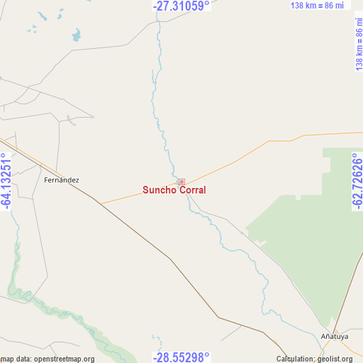
Suncho Corral GPS coordinates[2]
27° 56' 0.852" South, 63° 25' 45.768" West
| Map corner | latitude | longitude |
|---|---|---|
| Upper-left | -27.31059°, | -64.13251° |
| Center: | -27.93357°, | -63.42938° |
| Lower-right: | -28.55298°, | -62.72626° |
| Map W x H: | 138.1×138.1 km | = 85.8×85.8mi |
| max Lat: | -21.94467° ⇑24.5% North |
| Suncho Corral: | -27.93357° |
| min Lat: | ⇓75.5% South -54.81084° |
| min Long | Suncho Corral | max Long |
| -72.88605° | -63.42938° | -53.64581° |
| W 45%⇐ | ⇒55% E |
Elevation
Elevation of Suncho Corral is 135 m = 443 ft, and this is 214.3 m = 703 ft below average elevation for this country.
| Max E: |
4040 m = 13255 ft | 51.6% |
| Avg. | 349.3 m = 1146 ft | |
| Suncho Corral | 135 m = 443 ft | |
Min E: |
-2 m = -7 ft | 48.4% |
See also: Argentina elevation on elevation.city.
Geographical zone
Suncho Corral is located in South temperate zone (between Tropic of Capricorn and the Antarctic Circle). Distance of this Southern Tropic circle is 500 km =310.7 mi to North.| Distance of | km | miles | from Suncho Corral |
|---|---|---|---|
| Equator | 3105.9 | 1929.9 | to North |
| Tropic Capricorn | 500 | 310.7 | to North |
| Antarctic Circle | 4295.3 | 2669 | to South |
| South Pole | 6901.1 | 4288.1 | to South |


Nearby cities:
15 places around Suncho Corral: (largest is in red/bold)
• Arraga
78.9 km =49 mi,  260°
260°
• Añatuya
82.6 km =51.3 mi,  135°
135°
• Beltrán
63.2 km =39.3 mi,  280°
280°
• Brea Pozo
61.7 km =38.3 mi,  236°
236°
• Clodomira
79.8 km =49.6 mi,  300°
300°
• Colonia Dora
87.7 km =54.5 mi,  147°
147°
• El Hoyo
102.5 km =63.7 mi,  10°
10°
• Fernández
45.6 km =28.3 mi,  271°
271°
• Garza
26.7 km =16.6 mi,  203°
203°
• Herrera
70.4 km =43.7 mi, 149°
• La Banda
83 km =51.6 mi,  285°
285°
• La Cañada
42.1 km =26.2 mi,  306°
306°
• Quimilí
104.6 km =65 mi,  72°
72°
• Santiago del Estero
83.2 km =51.7 mi, 280°
• Villa Atamisqui
73.1 km =45.4 mi,  211°
211°
Sources, notices
• [Note1] Compared only with cities in Argentina existing in our database
• [Src1] Map data: © OpenStreetMap contributors (CC-BY-SA)
• [Src2] Other city data from geonames.org with taken over terms of usage.
• [Src3] Geographical zone / Annual Mean Temperature by Robert A. Rohde @ Wikipedia
