Añatuya geodata
Añatuya (Santiago del Estero) is a seat of a second-order administrative division; located in Argentina in America/Argentina/Cordoba (GMT-3) time zone. With population of 20,261 people, there are 182 cities with bigger population in this country. Compared to other cities in Argentina, 71.8% of cities are located further ↓South; 50.8% of cities are located further →East and 58.9% of cities have higher elevation than Añatuya. Note1


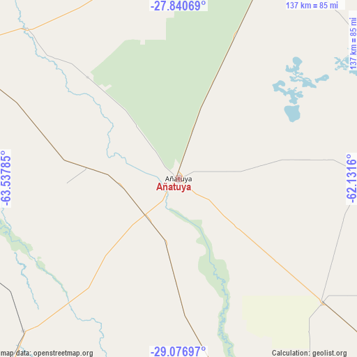
Añatuya GPS coordinates[2]
28° 27' 38.304" South, 62° 50' 4.992" West
| Map corner | latitude | longitude |
|---|---|---|
| Upper-left | -27.84069°, | -63.53785° |
| Center: | -28.46064°, | -62.83472° |
| Lower-right: | -29.07697°, | -62.1316° |
| Map W x H: | 137.5×137.5 km | = 85.4×85.4mi |
| max Lat: | -21.94467° ⇑28.2% North |
| Añatuya: | -28.46064° |
| min Lat: | ⇓71.8% South -54.81084° |
| min Long | Añatuya | max Long |
| -72.88605° | -62.83472° | -53.64581° |
| W 49.2%⇐ | ⇒50.8% E |
Elevation
Elevation of Añatuya is 111 m = 364 ft, and this is 238.3 m = 782 ft below average elevation for this country.
| Max E: |
4040 m = 13255 ft | 58.9% |
| Avg. | 349.3 m = 1146 ft | |
| Añatuya | 111 m = 364 ft | |
Min E: |
-2 m = -7 ft | 41.1% |
See also: Argentina elevation on elevation.city.
Geographical zone
Añatuya is located in South temperate zone (between Tropic of Capricorn and the Antarctic Circle). Distance of this Southern Tropic circle is 558.6 km =347.1 mi to North.| Distance of | km | miles | from Añatuya |
|---|---|---|---|
| Equator | 3164.5 | 1966.3 | to North |
| Tropic Capricorn | 558.6 | 347.1 | to North |
| Antarctic Circle | 4236.6 | 2632.5 | to South |
| South Pole | 6842.5 | 4251.7 | to South |


Nearby cities:
15 places around Añatuya: (largest is in red/bold)
• Bandera
73.1 km =45.4 mi,  130°
130°
• Brea Pozo
111.8 km =69.5 mi,  282°
282°
• Colonia Dora
19.2 km =11.9 mi,  216°
216°
• Fernández
119.9 km =74.5 mi,  300°
300°
• Garza
77 km =47.8 mi, 296°
• Herrera
22.9 km =14.2 mi,  264°
264°
• La Cañada
124.4 km =77.3 mi,  312°
312°
• Los Juríes
71 km =44.1 mi,  90°
90°
• Los Telares
83.6 km =51.9 mi,  225°
225°
• Quimilí
99.4 km =61.8 mi,  24°
24°
• Sumampa
119.9 km =74.5 mi,  210°
210°
• Suncho Corral
82.6 km =51.3 mi,  315°
315°
• Villa Atamisqui
96 km =59.7 mi,  267°
267°
• Villa General Mitre
77.9 km =48.4 mi,  166°
166°
• Villa Unión
106 km =65.9 mi,  177°
177°
Sources, notices
• [Note1] Compared only with cities in Argentina existing in our database
• [Src1] Map data: © OpenStreetMap contributors (CC-BY-SA)
• [Src2] Other city data from geonames.org with taken over terms of usage.
• [Src3] Geographical zone / Annual Mean Temperature by Robert A. Rohde @ Wikipedia
