Sebastián Elcano geodata
Sebastián Elcano (Cordoba) is a populated place; located in Argentina in America/Argentina/Cordoba (GMT-3) time zone. With population of 2,042 people, there are 642 cities with bigger population in this country. Compared to other cities in Argentina, 64.6% of cities are located further ↓South; 56.9% of cities are located further →East and 60% of cities have lower elevation than Sebastián Elcano. Note1


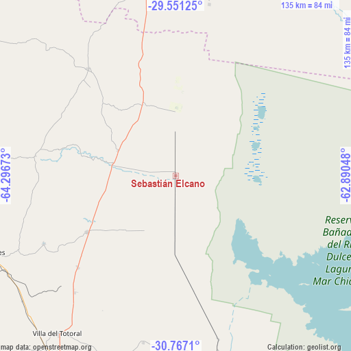
Sebastián Elcano GPS coordinates[2]
30° 9' 39.78" South, 63° 35' 36.96" West
| Map corner | latitude | longitude |
|---|---|---|
| Upper-left | -29.55125°, | -64.29673° |
| Center: | -30.16105°, | -63.5936° |
| Lower-right: | -30.7671°, | -62.89048° |
| Map W x H: | 135.2×135.2 km | = 84×84mi |
| max Lat: | -21.94467° ⇑35.4% North |
| Sebastián Elcano: | -30.16105° |
| min Lat: | ⇓64.6% South -54.81084° |
| min Long | Sebastián Elca | max Long |
| -72.88605° | -63.5936° | -53.64581° |
| W 43.1%⇐ | ⇒56.9% E |
Elevation
Elevation of Sebastián Elcano is 211 m = 692 ft, and this is 138.3 m = 454 ft below average elevation for this country.
| Max E: |
4040 m = 13255 ft | 40% |
| Avg. | 349.3 m = 1146 ft | |
| Sebastián Elcano | 211 m = 692 ft | |
Min E: |
-2 m = -7 ft | 60% |
See also: Argentina elevation on elevation.city.
Geographical zone
Sebastián Elcano is located in South temperate zone (between Tropic of Capricorn and the Antarctic Circle). Distance of this Southern Tropic circle is 747.7 km =464.6 mi to North.| Distance of | km | miles | from Sebastián Elcano |
|---|---|---|---|
| Equator | 3353.6 | 2083.8 | to North |
| Tropic Capricorn | 747.7 | 464.6 | to North |
| Antarctic Circle | 4047.6 | 2515.1 | to South |
| South Pole | 6653.5 | 4134.3 | to South |


Nearby cities:
15 places around Sebastián Elcano: (largest is in red/bold)
• Cañada de Luque
64.9 km =40.3 mi,  191°
191°
• Deán Funes
78.1 km =48.5 mi,  248°
248°
• Jesús María
103.1 km =64.1 mi,  207°
207°
• La Para
99.3 km =61.7 mi,  145°
145°
• Obispo Trejo
71.1 km =44.2 mi,  165°
165°
• Quilino
87.4 km =54.3 mi,  266°
266°
• San Francisco del Chañar
53.5 km =33.2 mi,  320°
320°
• San José de la Dormida
40.3 km =25 mi,  237°
237°
• Santa Rosa de Río Primero
111.7 km =69.4 mi, 170°
• Sumampa
87.2 km =54.2 mi,  7°
7°
• Villa Ojo de Agua
74.1 km =46 mi,  352°
352°
• Villa Tulumba
57.1 km =35.5 mi, 242°
• Villa Unión
113.8 km =70.7 mi,  43°
43°
• Villa de María
31.4 km =19.5 mi,  336°
336°
• Villa del Totoral
73.8 km =45.9 mi, 189°
Sources, notices
• [Note1] Compared only with cities in Argentina existing in our database
• [Src1] Map data: © OpenStreetMap contributors (CC-BY-SA)
• [Src2] Other city data from geonames.org with taken over terms of usage.
• [Src3] Geographical zone / Annual Mean Temperature by Robert A. Rohde @ Wikipedia
