San Carlos geodata
San Carlos (Cordoba) is a seat of a second-order administrative division; located in Argentina in America/Argentina/Cordoba (GMT-3) time zone. With population of 1,215 people, there are 734 cities with bigger population in this country. Compared to other cities in Argentina, 58.1% of cities are located further ↓South; 73.5% of cities are located further →East and 87.3% of cities have lower elevation than San Carlos. Note1


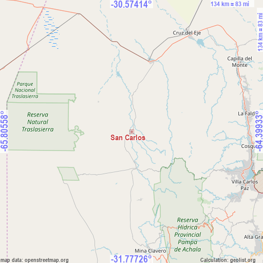
San Carlos GPS coordinates[2]
31° 10' 39.396" South, 65° 6' 8.82" West
| Map corner | latitude | longitude |
|---|---|---|
| Upper-left | -30.57414°, | -65.80558° |
| Center: | -31.17761°, | -65.10245° |
| Lower-right: | -31.77726°, | -64.39933° |
| Map W x H: | 133.8×133.8 km | = 83.1×83.1mi |
| max Lat: | -21.94467° ⇑41.9% North |
| San Carlos: | -31.17761° |
| min Lat: | ⇓58.1% South -54.81084° |
| min Long | San Carlos | max Long |
| -72.88605° | -65.10245° | -53.64581° |
| W 26.5%⇐ | ⇒73.5% E |
Elevation
Elevation of San Carlos is 756 m = 2480 ft, and this is 406.7 m = 1334 ft above average elevation for this country.
| Max E: |
4040 m = 13255 ft | 12.7% |
| San Carlos | 756 m 2480 ft | |
| Avg. | 349.3 m = 1146 ft | |
Min E: |
-2 m = -7 ft | 87.3% |
See also: Argentina elevation on elevation.city.
Geographical zone
San Carlos is located in South temperate zone (between Tropic of Capricorn and the Antarctic Circle). Distance of this Southern Tropic circle is 860.7 km =534.8 mi to North.| Distance of | km | miles | from San Carlos |
|---|---|---|---|
| Equator | 3466.6 | 2154 | to North |
| Tropic Capricorn | 860.7 | 534.8 | to North |
| Antarctic Circle | 3934.5 | 2444.8 | to South |
| South Pole | 6540.4 | 4064 | to South |


Nearby cities:
15 places around San Carlos: (largest is in red/bold)
• Capilla del Monte
65.3 km =40.6 mi,  57°
57°
• Cosquín
61 km =37.9 mi,  97°
97°
• Cruz del Eje
57.7 km =35.9 mi,  29°
29°
• Cuesta Blanca
61 km =37.9 mi,  124°
124°
• Huerta Grande
59.3 km =36.8 mi,  78°
78°
• La Cumbre
62.1 km =38.6 mi,  69°
69°
• La Falda
59.1 km =36.7 mi, 80°
• Los Cocos
63.7 km =39.6 mi, 63°
• Mina Clavero
61.1 km =38 mi,  171°
171°
• Salsacate
15.7 km =9.8 mi,  175°
175°
• Valle Hermoso
59.5 km =37 mi, 83°
• Villa Carlos Paz
63.7 km =39.6 mi, 115°
• Villa Cura Brochero
59.3 km =36.8 mi, 172°
• Villa Giardino
61.1 km =38 mi, 74°
• Villa de Soto
37.2 km =23.1 mi,  15°
15°
Sources, notices
• [Note1] Compared only with cities in Argentina existing in our database
• [Src1] Map data: © OpenStreetMap contributors (CC-BY-SA)
• [Src2] Other city data from geonames.org with taken over terms of usage.
• [Src3] Geographical zone / Annual Mean Temperature by Robert A. Rohde @ Wikipedia
