Cruz del Eje geodata
Cruz del Eje (Cordoba) is a seat of a second-order administrative division; located in Argentina in America/Argentina/Cordoba (GMT-3) time zone. With population of 28,166 people, there are 143 cities with bigger population in this country. Compared to other cities in Argentina, 62% of cities are located further ↓South; 71% of cities are located further →East and 75.7% of cities have lower elevation than Cruz del Eje. Note1


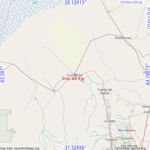
Cruz del Eje GPS coordinates[2]
30° 43' 35.184" South, 64° 48' 13.932" West
| Map corner | latitude | longitude |
|---|---|---|
| Upper-left | -30.12013°, | -65.507° |
| Center: | -30.72644°, | -64.80387° |
| Lower-right: | -31.32896°, | -64.10075° |
| Map W x H: | 134.4×134.4 km | = 83.5×83.5mi |
| max Lat: | -21.94467° ⇑38% North |
| Cruz del Eje: | -30.72644° |
| min Lat: | ⇓62% South -54.81084° |
| min Long | Cruz del Eje | max Long |
| -72.88605° | -64.80387° | -53.64581° |
| W 29%⇐ | ⇒71% E |
Elevation
Elevation of Cruz del Eje is 465 m = 1526 ft, and this is 115.7 m = 380 ft above average elevation for this country.
| Max E: |
4040 m = 13255 ft | 24.3% |
| Cruz del Eje | 465 m 1526 ft | |
| Avg. | 349.3 m = 1146 ft | |
Min E: |
-2 m = -7 ft | 75.7% |
See also: Argentina elevation on elevation.city.
Geographical zone
Cruz del Eje is located in South temperate zone (between Tropic of Capricorn and the Antarctic Circle). Distance of this Southern Tropic circle is 810.5 km =503.6 mi to North.| Distance of | km | miles | from Cruz del Eje |
|---|---|---|---|
| Equator | 3416.5 | 2122.9 | to North |
| Tropic Capricorn | 810.5 | 503.6 | to North |
| Antarctic Circle | 3984.7 | 2476 | to South |
| South Pole | 6590.6 | 4095.2 | to South |


Nearby cities:
15 places around Cruz del Eje: (largest is in red/bold)
• Agua de Oro
61.2 km =38 mi,  128°
128°
• Capilla del Monte
30.5 km =19 mi,  119°
119°
• Cosquín
66.1 km =41.1 mi,  150°
150°
• Deán Funes
55.2 km =34.3 mi,  51°
51°
• Huerta Grande
49 km =30.4 mi,  142°
142°
• La Cumbre
41.2 km =25.6 mi, 133°
• La Falda
50.2 km =31.2 mi, 143°
• La Granja
60 km =37.3 mi, 121°
• Los Cocos
36.3 km =22.6 mi, 127°
• Quilino
64 km =39.8 mi,  27°
27°
• San Carlos
57.7 km =35.9 mi,  209°
209°
• Serrezuela
56.6 km =35.2 mi,  280°
280°
• Valle Hermoso
53.3 km =33.1 mi, 144°
• Villa Giardino
45.8 km =28.5 mi, 138°
• Villa de Soto
23.5 km =14.6 mi,  232°
232°
Sources, notices
• [Note1] Compared only with cities in Argentina existing in our database
• [Src1] Map data: © OpenStreetMap contributors (CC-BY-SA)
• [Src2] Other city data from geonames.org with taken over terms of usage.
• [Src3] Geographical zone / Annual Mean Temperature by Robert A. Rohde @ Wikipedia
