Villa Cura Brochero geodata
Villa Cura Brochero (Cordoba) is a seat of a second-order administrative division; located in Argentina in America/Argentina/Cordoba (GMT-3) time zone. With population of 4,707 people, there are 454 cities with bigger population in this country. Compared to other cities in Argentina, 51.2% of cities are located further ↓South; 72.7% of cities are located further →East and 91.1% of cities have lower elevation than Villa Cura Brochero. Note1


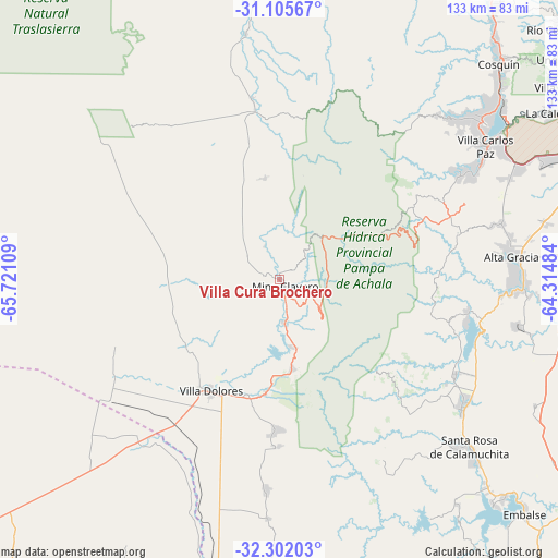
Villa Cura Brochero GPS coordinates[2]
31° 42' 20.808" South, 65° 1' 4.656" West
| Map corner | latitude | longitude |
|---|---|---|
| Upper-left | -31.10567°, | -65.72109° |
| Center: | -31.70578°, | -65.01796° |
| Lower-right: | -32.30203°, | -64.31484° |
| Map W x H: | 133×133 km | = 82.6×82.6mi |
| max Lat: | -21.94467° ⇑48.8% North |
| Villa Cura Brochero: | -31.70578° |
| min Lat: | ⇓51.2% South -54.81084° |
| min Long | Villa Cura Broc | max Long |
| -72.88605° | -65.01796° | -53.64581° |
| W 27.3%⇐ | ⇒72.7% E |
Elevation
Elevation of Villa Cura Brochero is 909 m = 2982 ft, and this is 559.7 m = 1836 ft above average elevation for this country.
| Max E: |
4040 m = 13255 ft | 8.9% |
| Villa Cura Brochero | 909 m 2982 ft | |
| Avg. | 349.3 m = 1146 ft | |
Min E: |
-2 m = -7 ft | 91.1% |
See also: Argentina elevation on elevation.city.
Geographical zone
Villa Cura Brochero is located in South temperate zone (between Tropic of Capricorn and the Antarctic Circle). Distance of this Southern Tropic circle is 919.4 km =571.3 mi to North.| Distance of | km | miles | from Villa Cura Brochero |
|---|---|---|---|
| Equator | 3525.4 | 2190.6 | to North |
| Tropic Capricorn | 919.4 | 571.3 | to North |
| Antarctic Circle | 3875.8 | 2408.3 | to South |
| South Pole | 6481.7 | 4027.5 | to South |


Nearby cities:
15 places around Villa Cura Brochero: (largest is in red/bold)
• Alta Gracia
56.1 km =34.9 mi,  83°
83°
• Cuesta Blanca
48.8 km =30.3 mi,  60°
60°
• Despeñaderos
69.9 km =43.4 mi,  100°
100°
• La Cumbrecita
31.5 km =19.6 mi,  132°
132°
• Malagueño
68 km =42.3 mi,  66°
66°
• Mina Clavero
2 km =1.2 mi,  146°
146°
• Salsacate
43.6 km =27.1 mi,  350°
350°
• San Agustín
67.9 km =42.2 mi,  116°
116°
• San Carlos
59.3 km =36.8 mi, 352°
• Santa Rosa de Calamuchita
60.8 km =37.8 mi, 131°
• Villa Berna
35.6 km =22.1 mi, 130°
• Villa Carlos Paz
58.4 km =36.3 mi, 57°
• Villa Dolores
31.2 km =19.4 mi,  211°
211°
• Villa General Belgrano
53.1 km =33 mi, 124°
• Villa Las Rosas
27.4 km =17 mi,  187°
187°
Sources, notices
• [Note1] Compared only with cities in Argentina existing in our database
• [Src1] Map data: © OpenStreetMap contributors (CC-BY-SA)
• [Src2] Other city data from geonames.org with taken over terms of usage.
• [Src3] Geographical zone / Annual Mean Temperature by Robert A. Rohde @ Wikipedia
