San Antonio Oeste geodata
San Antonio Oeste (Rio Negro) is a seat of a second-order administrative division; located in Argentina in America/Argentina/Salta (GMT-3) time zone. With population of 16,966 people, there are 207 cities with bigger population in this country. Compared to other cities in Argentina, 94.4% of cities are located further ↑North; 71.7% of cities are located further →East and 97.3% of cities have higher elevation than San Antonio Oeste. Note1


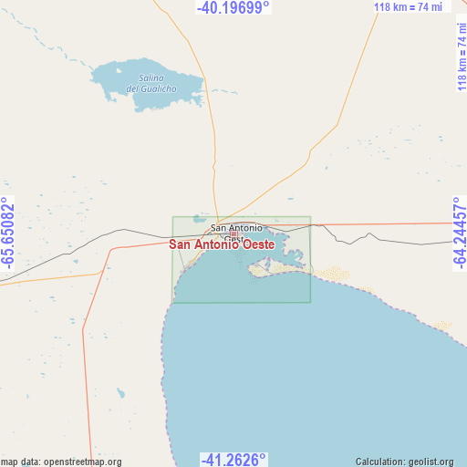
San Antonio Oeste GPS coordinates[2]
40° 43' 54.948" South, 64° 56' 51.684" West
| Map corner | latitude | longitude |
|---|---|---|
| Upper-left | -40.19699°, | -65.65082° |
| Center: | -40.73193°, | -64.94769° |
| Lower-right: | -41.2626°, | -64.24457° |
| Map W x H: | 118.5×118.5 km | = 73.6×73.6mi |
| max Lat: | -21.94467° ⇑94.4% North |
| San Antonio Oeste: | -40.73193° |
| min Lat: | ⇓5.6% South -54.81084° |
| min Long | San Antonio Oes | max Long |
| -72.88605° | -64.94769° | -53.64581° |
| W 28.3%⇐ | ⇒71.7% E |
Elevation
Elevation of San Antonio Oeste is 12 m = 39 ft, and this is 337.3 m = 1107 ft below average elevation for this country.
| Max E: |
4040 m = 13255 ft | 97.3% |
| Avg. | 349.3 m = 1146 ft | |
| San Antonio Oeste | 12 m = 39 ft | |
Min E: |
-2 m = -7 ft | 2.7% |
See also: Argentina elevation on elevation.city.
Geographical zone
San Antonio Oeste is located in South temperate zone (between Tropic of Capricorn and the Antarctic Circle). Distance of this Southern Tropic circle is 1923 km =1194.9 mi to North.| Distance of | km | miles | from San Antonio Oeste |
|---|---|---|---|
| Equator | 4529 | 2814.2 | to North |
| Tropic Capricorn | 1923 | 1194.9 | to North |
| Antarctic Circle | 2872.2 | 1784.7 | to South |
| South Pole | 5478.1 | 3403.9 | to South |


Nearby cities:
15 places around San Antonio Oeste: (largest is in red/bold)
• Carmen de Patagones
165.8 km =103 mi,  92°
92°
• Chimpay
201.8 km =125.4 mi,  329°
329°
• Choele Choel
171.5 km =106.6 mi,  339°
339°
• Coronel Belisle
192 km =119.3 mi, 333°
• Darwin
182.9 km =113.6 mi, 338°
• Fray Luis Beltrán
172.2 km =107 mi, 336°
• General Conesa
81.3 km =50.5 mi,  30°
30°
• La Adela
207.9 km =129.2 mi,  20°
20°
• Lamarque
159.1 km =98.9 mi, 336°
• Puerto Madryn
226.6 km =140.8 mi,  181°
181°
• Río Colorado
206.6 km =128.4 mi, 20°
• Sierra Colorada
237.5 km =147.6 mi,  273°
273°
• Sierra Grande
103 km =64 mi,  199°
199°
• Valcheta
102.6 km =63.8 mi, 273°
• Viedma
164.5 km =102.2 mi, 93°
Sources, notices
• [Note1] Compared only with cities in Argentina existing in our database
• [Src1] Map data: © OpenStreetMap contributors (CC-BY-SA)
• [Src2] Other city data from geonames.org with taken over terms of usage.
• [Src3] Geographical zone / Annual Mean Temperature by Robert A. Rohde @ Wikipedia
