Sierra Grande geodata
Sierra Grande (Rio Negro) is a populated place; located in Argentina in America/Argentina/Salta (GMT-3) time zone. With population of 6,978 people, there are 363 cities with bigger population in this country. Compared to other cities in Argentina, 95.4% of cities are located further ↑North; 76.2% of cities are located further →East and 63.3% of cities have lower elevation than Sierra Grande. Note1


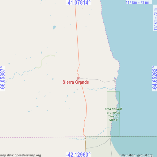
Sierra Grande GPS coordinates[2]
41° 36' 21.708" South, 65° 21' 20.664" West
| Map corner | latitude | longitude |
|---|---|---|
| Upper-left | -41.07814°, | -66.05887° |
| Center: | -41.60603°, | -65.35574° |
| Lower-right: | -42.12963°, | -64.65262° |
| Map W x H: | 116.9×116.9 km | = 72.6×72.6mi |
| max Lat: | -21.94467° ⇑95.4% North |
| Sierra Grande: | -41.60603° |
| min Lat: | ⇓4.6% South -54.81084° |
| min Long | Sierra Grande | max Long |
| -72.88605° | -65.35574° | -53.64581° |
| W 23.8%⇐ | ⇒76.2% E |
Elevation
Elevation of Sierra Grande is 245 m = 804 ft, and this is 104.3 m = 342 ft below average elevation for this country.
| Max E: |
4040 m = 13255 ft | 36.7% |
| Avg. | 349.3 m = 1146 ft | |
| Sierra Grande | 245 m = 804 ft | |
Min E: |
-2 m = -7 ft | 63.3% |
See also: Argentina elevation on elevation.city.
Geographical zone
Sierra Grande is located in South temperate zone (between Tropic of Capricorn and the Antarctic Circle). Distance of this Southern Tropic circle is 2020.2 km =1255.3 mi to North.| Distance of | km | miles | from Sierra Grande |
|---|---|---|---|
| Equator | 4626.2 | 2874.6 | to North |
| Tropic Capricorn | 2020.2 | 1255.3 | to North |
| Antarctic Circle | 2775 | 1724.3 | to South |
| South Pole | 5380.9 | 3343.5 | to South |


Nearby cities:
15 places around Sierra Grande: (largest is in red/bold)
• Carmen de Patagones
218 km =135.5 mi,  65°
65°
• Dolavón
191.3 km =118.9 mi,  188°
188°
• Fray Luis Beltrán
257.2 km =159.8 mi,  352°
352°
• Gaimán
187.5 km =116.5 mi,  183°
183°
• General Conesa
183.3 km =113.9 mi,  24°
24°
• Lamarque
244.5 km =151.9 mi, 353°
• Los Menucos
243.6 km =151.4 mi,  290°
290°
• Puerto Madryn
131.9 km =82 mi,  168°
168°
• Rawson
189.5 km =117.7 mi, 173°
• San Antonio Oeste
103 km =64 mi, 19°
• Sierra Colorada
231 km =143.5 mi,  299°
299°
• Telsen
160.1 km =99.5 mi,  234°
234°
• Trelew
182.7 km =113.5 mi, 178°
• Valcheta
123.2 km =76.6 mi,  326°
326°
• Viedma
216.1 km =134.3 mi, 65°
Sources, notices
• [Note1] Compared only with cities in Argentina existing in our database
• [Src1] Map data: © OpenStreetMap contributors (CC-BY-SA)
• [Src2] Other city data from geonames.org with taken over terms of usage.
• [Src3] Geographical zone / Annual Mean Temperature by Robert A. Rohde @ Wikipedia
