Intendente Alvear geodata
Intendente Alvear (La Pampa) is a seat of a second-order administrative division; located in Argentina in America/Argentina/Salta (GMT-3) time zone. With population of 6,990 people, there are 362 cities with bigger population in this country. Compared to other cities in Argentina, 79% of cities are located further ↑North; 56.8% of cities are located further →East and 53% of cities have higher elevation than Intendente Alvear. Note1


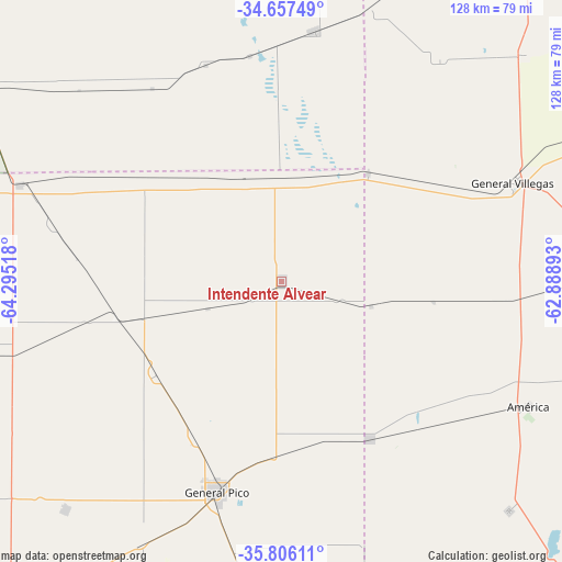
Intendente Alvear GPS coordinates[2]
35° 14' 1.788" South, 63° 35' 31.38" West
| Map corner | latitude | longitude |
|---|---|---|
| Upper-left | -34.65749°, | -64.29518° |
| Center: | -35.23383°, | -63.59205° |
| Lower-right: | -35.80611°, | -62.88893° |
| Map W x H: | 127.7×127.7 km | = 79.3×79.3mi |
| max Lat: | -21.94467° ⇑79% North |
| Intendente Alvear: | -35.23383° |
| min Lat: | ⇓21% South -54.81084° |
| min Long | Intendente Alve | max Long |
| -72.88605° | -63.59205° | -53.64581° |
| W 43.2%⇐ | ⇒56.8% E |
Elevation
Elevation of Intendente Alvear is 129 m = 423 ft, and this is 220.3 m = 723 ft below average elevation for this country.
| Max E: |
4040 m = 13255 ft | 53% |
| Avg. | 349.3 m = 1146 ft | |
| Intendente Alvear | 129 m = 423 ft | |
Min E: |
-2 m = -7 ft | 47% |
See also: Argentina elevation on elevation.city.
Geographical zone
Intendente Alvear is located in South temperate zone (between Tropic of Capricorn and the Antarctic Circle). Distance of this Southern Tropic circle is 1311.7 km =815.1 mi to North.| Distance of | km | miles | from Intendente Alvear |
|---|---|---|---|
| Equator | 3917.6 | 2434.3 | to North |
| Tropic Capricorn | 1311.7 | 815.1 | to North |
| Antarctic Circle | 3483.5 | 2164.5 | to South |
| South Pole | 6089.4 | 3783.8 | to South |


Nearby cities:
15 places around Intendente Alvear: (largest is in red/bold)
• Alta Italia
48.7 km =30.3 mi,  256°
256°
• Arata
82.6 km =51.3 mi,  236°
236°
• Bernardo Larroudé
23.3 km =14.5 mi,  2°
2°
• Buchardo
57.3 km =35.6 mi,  7°
7°
• Embajador Martini
64.8 km =40.3 mi,  254°
254°
• General Pico
49.3 km =30.6 mi,  197°
197°
• General Villegas
57.2 km =35.5 mi,  67°
67°
• Huinca Renancó
83.7 km =52 mi,  301°
301°
• Ingeniero Luiggi
81 km =50.3 mi, 257°
• Italó
52 km =32.3 mi,  340°
340°
• Parera
83.2 km =51.7 mi,  276°
276°
• Realicó
63.3 km =39.3 mi,  290°
290°
• Serrano
85.1 km =52.9 mi, 3°
• Trenel
71.1 km =44.2 mi,  223°
223°
• Tres Algarrobos
74.4 km =46.2 mi,  86°
86°
Sources, notices
• [Note1] Compared only with cities in Argentina existing in our database
• [Src1] Map data: © OpenStreetMap contributors (CC-BY-SA)
• [Src2] Other city data from geonames.org with taken over terms of usage.
• [Src3] Geographical zone / Annual Mean Temperature by Robert A. Rohde @ Wikipedia
