Arata geodata
Arata (La Pampa) is a populated place; located in Argentina in America/Argentina/Salta (GMT-3) time zone. With population of 1,202 people, there are 738 cities with bigger population in this country. Compared to other cities in Argentina, 80.6% of cities are located further ↑North; 66.2% of cities are located further →East and 60.6% of cities have lower elevation than Arata. Note1


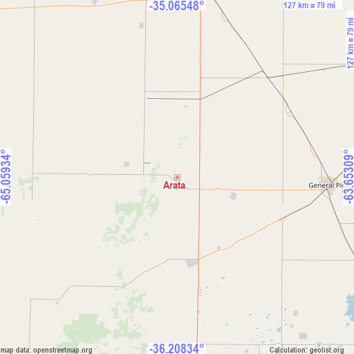
Arata GPS coordinates[2]
35° 38' 20.22" South, 64° 21' 22.356" West
| Map corner | latitude | longitude |
|---|---|---|
| Upper-left | -35.06548°, | -65.05934° |
| Center: | -35.63895°, | -64.35621° |
| Lower-right: | -36.20834°, | -63.65309° |
| Map W x H: | 127.1×127.1 km | = 79×79mi |
| max Lat: | -21.94467° ⇑80.6% North |
| Arata: | -35.63895° |
| min Lat: | ⇓19.4% South -54.81084° |
| min Long | Arata | max Long |
| -72.88605° | -64.35621° | -53.64581° |
| W 33.8%⇐ | ⇒66.2% E |
Elevation
Elevation of Arata is 217 m = 712 ft, and this is 132.3 m = 434 ft below average elevation for this country.
| Max E: |
4040 m = 13255 ft | 39.4% |
| Avg. | 349.3 m = 1146 ft | |
| Arata | 217 m = 712 ft | |
Min E: |
-2 m = -7 ft | 60.6% |
See also: Argentina elevation on elevation.city.
Geographical zone
Arata is located in South temperate zone (between Tropic of Capricorn and the Antarctic Circle). Distance of this Southern Tropic circle is 1356.8 km =843.1 mi to North.| Distance of | km | miles | from Arata |
|---|---|---|---|
| Equator | 3962.7 | 2462.3 | to North |
| Tropic Capricorn | 1356.8 | 843.1 | to North |
| Antarctic Circle | 3438.5 | 2136.6 | to South |
| South Pole | 6044.4 | 3755.8 | to South |


Nearby cities:
15 places around Arata: (largest is in red/bold)
• Alta Italia
40.4 km =25.1 mi,  32°
32°
• Caleufú
18.8 km =11.7 mi,  284°
284°
• Colonia Barón
72.8 km =45.2 mi,  141°
141°
• Eduardo Castex
31.2 km =19.4 mi,  169°
169°
• Embajador Martini
28.9 km =18 mi,  13°
13°
• General Pico
54.2 km =33.7 mi,  92°
92°
• Ingeniero Luiggi
29.8 km =18.5 mi,  340°
340°
• Intendente Alvear
82.6 km =51.3 mi,  56°
56°
• La Maruja
52.9 km =32.9 mi,  265°
265°
• Parera
56.4 km =35 mi,  346°
346°
• Quemú Quemú
85 km =52.8 mi,  122°
122°
• Rancul
69.9 km =43.4 mi, 335°
• Realicó
67.7 km =42.1 mi, 8°
• Trenel
21.3 km =13.2 mi,  108°
108°
• Winifreda
66.2 km =41.1 mi, 170°
Sources, notices
• [Note1] Compared only with cities in Argentina existing in our database
• [Src1] Map data: © OpenStreetMap contributors (CC-BY-SA)
• [Src2] Other city data from geonames.org with taken over terms of usage.
• [Src3] Geographical zone / Annual Mean Temperature by Robert A. Rohde @ Wikipedia
