Palma Sola geodata
Palma Sola (Jujuy) is a populated place; located in Argentina in America/Argentina/Jujuy (GMT-3) time zone. With population of 5,318 people, there are 433 cities with bigger population in this country. Compared to other cities in Argentina, 97.6% of cities are located further ↓South; 65.3% of cities are located further →East and 84.2% of cities have lower elevation than Palma Sola. Note1


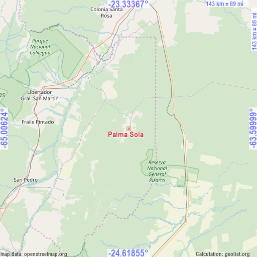
Palma Sola GPS coordinates[2]
23° 58' 39.756" South, 64° 18' 11.196" West
| Map corner | latitude | longitude |
|---|---|---|
| Upper-left | -23.33367°, | -65.00624° |
| Center: | -23.97771°, | -64.30311° |
| Lower-right: | -24.61855°, | -63.59999° |
| Map W x H: | 142.9×142.9 km | = 88.8×88.8mi |
| max Lat: | -21.94467° ⇑2.4% North |
| Palma Sola: | -23.97771° |
| min Lat: | ⇓97.6% South -54.81084° |
| min Long | Palma Sola | max Long |
| -72.88605° | -64.30311° | -53.64581° |
| W 34.7%⇐ | ⇒65.3% E |
Elevation
Elevation of Palma Sola is 664 m = 2178 ft, and this is 314.7 m = 1032 ft above average elevation for this country.
| Max E: |
4040 m = 13255 ft | 15.8% |
| Palma Sola | 664 m 2178 ft | |
| Avg. | 349.3 m = 1146 ft | |
Min E: |
-2 m = -7 ft | 84.2% |
See also: Argentina elevation on elevation.city.
Geographical zone
Palma Sola is located in South temperate zone (between Tropic of Capricorn and the Antarctic Circle). Distance of this Southern Tropic circle is 60.2 km =37.4 mi to North.| Distance of | km | miles | from Palma Sola |
|---|---|---|---|
| Equator | 2666.1 | 1656.6 | to North |
| Tropic Capricorn | 60.2 | 37.4 | to North |
| Antarctic Circle | 4735.1 | 2942.3 | to South |
| South Pole | 7341 | 4561.5 | to South |


Nearby cities:
15 places around Palma Sola: (largest is in red/bold)
• Apolinario Saravia
59.4 km =36.9 mi,  148°
148°
• Caimancito
39.6 km =24.6 mi,  311°
311°
• Calilegua
52.6 km =32.7 mi,  295°
295°
• Embarcación
87.8 km =54.6 mi,  13°
13°
• Fraile Pintado
50.6 km =31.4 mi,  274°
274°
• Ingenio La Esperanza
61 km =37.9 mi,  243°
243°
• La Mendieta
76.6 km =47.6 mi, 241°
• Las Lajitas
84.1 km =52.3 mi,  172°
172°
• Libertador General San Martín
52.8 km =32.8 mi,  291°
291°
• Palpalá
97.3 km =60.5 mi,  251°
251°
• San Pedro de Jujuy
63.7 km =39.6 mi, 243°
• San Ramón de la Nueva Orán
93.5 km =58.1 mi,  358°
358°
• Santa Clara
51.9 km =32.2 mi,  224°
224°
• Valle Grande
86.2 km =53.6 mi, 310°
• Yuto
40.9 km =25.4 mi,  335°
335°
Sources, notices
• [Note1] Compared only with cities in Argentina existing in our database
• [Src1] Map data: © OpenStreetMap contributors (CC-BY-SA)
• [Src2] Other city data from geonames.org with taken over terms of usage.
• [Src3] Geographical zone / Annual Mean Temperature by Robert A. Rohde @ Wikipedia
