Embarcación geodata
Embarcación (Salta) is a populated place; located in Argentina in America/Argentina/Salta (GMT-3) time zone. With population of 23,961 people, there are 168 cities with bigger population in this country. Compared to other cities in Argentina, 99% of cities are located further ↓South; 62.3% of cities are located further →East and 66.5% of cities have lower elevation than Embarcación. Note1


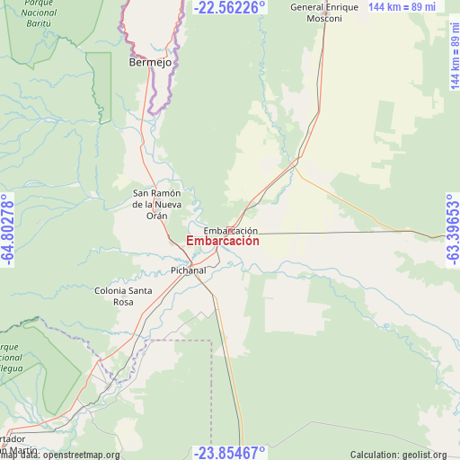
Embarcación GPS coordinates[2]
23° 12' 36.108" South, 64° 5' 58.74" West
| Map corner | latitude | longitude |
|---|---|---|
| Upper-left | -22.56226°, | -64.80278° |
| Center: | -23.21003°, | -64.09965° |
| Lower-right: | -23.85467°, | -63.39653° |
| Map W x H: | 143.7×143.7 km | = 89.3×89.3mi |
| max Lat: | -21.94467° ⇑1% North |
| Embarcación: | -23.21003° |
| min Lat: | ⇓99% South -54.81084° |
| min Long | Embarcación | max Long |
| -72.88605° | -64.09965° | -53.64581° |
| W 37.7%⇐ | ⇒62.3% E |
Elevation
Elevation of Embarcación is 292 m = 958 ft, and this is 57.3 m = 188 ft below average elevation for this country.
| Max E: |
4040 m = 13255 ft | 33.5% |
| Avg. | 349.3 m = 1146 ft | |
| Embarcación | 292 m = 958 ft | |
Min E: |
-2 m = -7 ft | 66.5% |
See also: Argentina elevation on elevation.city.
Geographical zone
Embarcación is located in South Torrid zone (between Equator and Tropic of Capricorn). Distance of this Southern Tropic circle is 25.2 km =15.7 mi to South.| Distance of | km | miles | from Embarcación |
|---|---|---|---|
| Equator | 2580.7 | 1603.6 | to North |
| Tropic Capricorn | 25.2 | 15.7 | to South |
| Antarctic Circle | 4820.5 | 2995.3 | to South |
| South Pole | 7426.3 | 4614.5 | to South |


Nearby cities:
15 places around Embarcación: (largest is in red/bold)
• Apolinario Saravia
136.4 km =84.8 mi,  175°
175°
• Caimancito
77.6 km =48.2 mi,  220°
220°
• Calilegua
92.7 km =57.6 mi,  227°
227°
• Fraile Pintado
108.1 km =67.2 mi, 221°
• General Enrique Mosconi
74.3 km =46.2 mi,  23°
23°
• Humahuaca
127.8 km =79.4 mi,  270°
270°
• Ingenio La Esperanza
135.7 km =84.3 mi,  213°
213°
• Iruya
123.5 km =76.7 mi,  292°
292°
• Libertador General San Martín
96.5 km =60 mi, 226°
• Palma Sola
87.8 km =54.6 mi,  193°
193°
• San Ramón de la Nueva Orán
24.4 km =15.2 mi, 289°
• Santa Clara
135 km =83.9 mi, 205°
• Tartagal
83 km =51.6 mi, 21°
• Valle Grande
91.5 km =56.9 mi,  251°
251°
• Yuto
61.4 km =38.2 mi, 218°
Sources, notices
• [Note1] Compared only with cities in Argentina existing in our database
• [Src1] Map data: © OpenStreetMap contributors (CC-BY-SA)
• [Src2] Other city data from geonames.org with taken over terms of usage.
• [Src3] Geographical zone / Annual Mean Temperature by Robert A. Rohde @ Wikipedia
