La Caldera geodata
La Caldera (Salta) is a seat of a second-order administrative division; located in Argentina in America/Argentina/Salta (GMT-3) time zone. In our database, there are 785 cities with bigger population. Compared to other cities in Argentina, 96.2% of cities are located further ↓South; 76.6% of cities are located further →East and 96.5% of cities have lower elevation than La Caldera. Note1


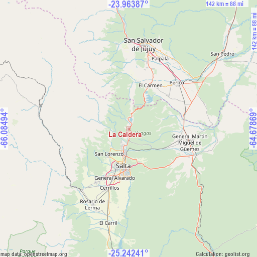
La Caldera GPS coordinates[2]
24° 36' 17.172" South, 65° 22' 54.516" West
| Map corner | latitude | longitude |
|---|---|---|
| Upper-left | -23.96387°, | -66.08494° |
| Center: | -24.60477°, | -65.38181° |
| Lower-right: | -25.24241°, | -64.67869° |
| Map W x H: | 142.2×142.2 km | = 88.4×88.4mi |
| max Lat: | -21.94467° ⇑3.8% North |
| La Caldera: | -24.60477° |
| min Lat: | ⇓96.2% South -54.81084° |
| min Long | La Caldera | max Long |
| -72.88605° | -65.38181° | -53.64581° |
| W 23.4%⇐ | ⇒76.6% E |
Elevation
Elevation of La Caldera is 1389 m = 4557 ft, and this is 1039.7 m = 3411 ft above average elevation for this country.
| Max E: |
4040 m = 13255 ft | 3.5% |
| La Caldera | 1389 m 4557 ft | |
| Avg. | 349.3 m = 1146 ft | |
Min E: |
-2 m = -7 ft | 96.5% |
See also: Argentina elevation on elevation.city.
Geographical zone
La Caldera is located in South temperate zone (between Tropic of Capricorn and the Antarctic Circle). Distance of this Southern Tropic circle is 129.9 km =80.7 mi to North.| Distance of | km | miles | from La Caldera |
|---|---|---|---|
| Equator | 2735.8 | 1699.9 | to North |
| Tropic Capricorn | 129.9 | 80.7 | to North |
| Antarctic Circle | 4665.4 | 2898.9 | to South |
| South Pole | 7271.3 | 4518.2 | to South |


Nearby cities:
15 places around La Caldera: (largest is in red/bold)
• Campo Quijano
42.6 km =26.5 mi,  217°
217°
• Cerrillos
34.3 km =21.3 mi,  198°
198°
• Chicoana
57.7 km =35.9 mi, 195°
• El Carmen
27.1 km =16.8 mi,  26°
26°
• El Carril
53.4 km =33.2 mi,  192°
192°
• General Martín Miguel de Güemes
34.6 km =21.5 mi,  102°
102°
• Ingenio La Esperanza
69.3 km =43.1 mi,  52°
52°
• La Mendieta
53.4 km =33.2 mi, 52°
• Palpalá
42.4 km =26.3 mi,  23°
23°
• Rosario de Lerma
46.4 km =28.8 mi,  205°
205°
• Salta
20.4 km =12.7 mi, 188°
• San Antonio
26.8 km =16.7 mi,  10°
10°
• San Pedro de Jujuy
66.7 km =41.4 mi, 51°
• San Salvador de Jujuy
46.4 km =28.8 mi, 10°
• Santa Rosa de Tastil
62.3 km =38.7 mi,  285°
285°
Sources, notices
• [Note1] Compared only with cities in Argentina existing in our database
• [Src1] Map data: © OpenStreetMap contributors (CC-BY-SA)
• [Src2] Other city data from geonames.org with taken over terms of usage.
• [Src3] Geographical zone / Annual Mean Temperature by Robert A. Rohde @ Wikipedia
