Santa Rosa de Tastil geodata
Santa Rosa de Tastil (Salta) is a populated place; located in Argentina in America/Argentina/Salta (GMT-3) time zone. With population of 2,000 people, there are 646 cities with bigger population in this country. Compared to other cities in Argentina, 96.3% of cities are located further ↓South; 81.9% of cities are located further →East and 99.2% of cities have lower elevation than Santa Rosa de Tastil. Note1


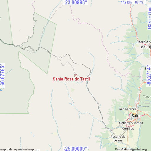
Santa Rosa de Tastil GPS coordinates[2]
24° 27' 5.976" South, 65° 58' 28.272" West
| Map corner | latitude | longitude |
|---|---|---|
| Upper-left | -23.80998°, | -66.67765° |
| Center: | -24.45166°, | -65.97452° |
| Lower-right: | -25.09009°, | -65.2714° |
| Map W x H: | 142.3×142.3 km | = 88.4×88.4mi |
| max Lat: | -21.94467° ⇑3.7% North |
| Santa Rosa de Tastil: | -24.45166° |
| min Lat: | ⇓96.3% South -54.81084° |
| min Long | Santa Rosa de T | max Long |
| -72.88605° | -65.97452° | -53.64581° |
| W 18.1%⇐ | ⇒81.9% E |
Elevation
Elevation of Santa Rosa de Tastil is 3220 m = 10564 ft, and this is 2870.7 m = 9418 ft above average elevation for this country.
| Max E: |
4040 m = 13255 ft | 0.8% |
| Santa Rosa de Tastil | 3220 m 10564 ft | |
| Avg. | 349.3 m = 1146 ft | |
Min E: |
-2 m = -7 ft | 99.2% |
See also: Argentina elevation on elevation.city.
Geographical zone
Santa Rosa de Tastil is located in South temperate zone (between Tropic of Capricorn and the Antarctic Circle). Distance of this Southern Tropic circle is 112.9 km =70.2 mi to North.| Distance of | km | miles | from Santa Rosa de Tastil |
|---|---|---|---|
| Equator | 2718.8 | 1689.4 | to North |
| Tropic Capricorn | 112.9 | 70.2 | to North |
| Antarctic Circle | 4682.4 | 2909.5 | to South |
| South Pole | 7288.3 | 4528.7 | to South |


Nearby cities:
15 places around Santa Rosa de Tastil: (largest is in red/bold)
• Cachí
76.8 km =47.7 mi,  194°
194°
• Campo Quijano
61.3 km =38.1 mi,  146°
146°
• Cerrillos
69.9 km =43.4 mi,  135°
135°
• Chicoana
85.1 km =52.9 mi, 148°
• El Carmen
72.5 km =45 mi,  84°
84°
• El Carril
84.7 km =52.6 mi, 144°
• La Caldera
62.3 km =38.7 mi,  105°
105°
• La Poma
37.8 km =23.5 mi,  217°
217°
• Palpalá
80.3 km =49.9 mi,  74°
74°
• Rosario de Lerma
71.2 km =44.2 mi, 145°
• Salta
68 km =42.3 mi,  123°
123°
• San Antonio
65.5 km =40.7 mi, 81°
• San Antonio de los Cobres
43.5 km =27 mi,  306°
306°
• San Salvador de Jujuy
74.3 km =46.2 mi, 67°
• Tumbaya
83.7 km =52 mi,  37°
37°
Sources, notices
• [Note1] Compared only with cities in Argentina existing in our database
• [Src1] Map data: © OpenStreetMap contributors (CC-BY-SA)
• [Src2] Other city data from geonames.org with taken over terms of usage.
• [Src3] Geographical zone / Annual Mean Temperature by Robert A. Rohde @ Wikipedia
