El Carril geodata
El Carril (Salta) is a populated place; located in Argentina in America/Argentina/Salta (GMT-3) time zone. With population of 9,780 people, there are 297 cities with bigger population in this country. Compared to other cities in Argentina, 94.9% of cities are located further ↓South; 77.7% of cities are located further →East and 94.2% of cities have lower elevation than El Carril. Note1


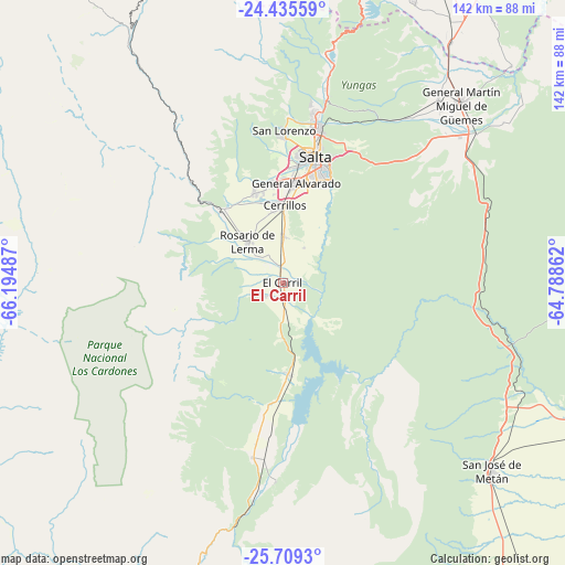
El Carril GPS coordinates[2]
25° 4' 26.76" South, 65° 29' 30.264" West
| Map corner | latitude | longitude |
|---|---|---|
| Upper-left | -24.43559°, | -66.19487° |
| Center: | -25.0741°, | -65.49174° |
| Lower-right: | -25.7093°, | -64.78862° |
| Map W x H: | 141.6×141.6 km | = 88×88mi |
| max Lat: | -21.94467° ⇑5.1% North |
| El Carril: | -25.0741° |
| min Lat: | ⇓94.9% South -54.81084° |
| min Long | El Carril | max Long |
| -72.88605° | -65.49174° | -53.64581° |
| W 22.3%⇐ | ⇒77.7% E |
Elevation
Elevation of El Carril is 1168 m = 3832 ft, and this is 818.7 m = 2686 ft above average elevation for this country.
| Max E: |
4040 m = 13255 ft | 5.8% |
| El Carril | 1168 m 3832 ft | |
| Avg. | 349.3 m = 1146 ft | |
Min E: |
-2 m = -7 ft | 94.2% |
See also: Argentina elevation on elevation.city.
Geographical zone
El Carril is located in South temperate zone (between Tropic of Capricorn and the Antarctic Circle). Distance of this Southern Tropic circle is 182.1 km =113.2 mi to North.| Distance of | km | miles | from El Carril |
|---|---|---|---|
| Equator | 2788 | 1732.4 | to North |
| Tropic Capricorn | 182.1 | 113.2 | to North |
| Antarctic Circle | 4613.2 | 2866.5 | to South |
| South Pole | 7219.1 | 4485.7 | to South |


Nearby cities:
15 places around El Carril: (largest is in red/bold)
• Cachí
68 km =42.3 mi,  265°
265°
• Campo Quijano
23.4 km =14.5 mi,  321°
321°
• Cerrillos
19.5 km =12.1 mi,  1°
1°
• Chicoana
5.5 km =3.4 mi,  231°
231°
• El Carmen
79.9 km =49.6 mi,  16°
16°
• General Martín Miguel de Güemes
63.4 km =39.4 mi,  44°
44°
• Guachipas
49.6 km =30.8 mi,  182°
182°
• La Caldera
53.4 km =33.2 mi,  12°
12°
• La Poma
81.6 km =50.7 mi,  298°
298°
• La Viña
44.3 km =27.5 mi,  189°
189°
• Metán
70.3 km =43.7 mi,  132°
132°
• Rosario de Lerma
13.5 km =8.4 mi, 319°
• Salta
33 km =20.5 mi, 14°
• San Antonio
80.1 km =49.8 mi, 11°
• Santa Rosa de Tastil
84.7 km =52.6 mi, 324°
Sources, notices
• [Note1] Compared only with cities in Argentina existing in our database
• [Src1] Map data: © OpenStreetMap contributors (CC-BY-SA)
• [Src2] Other city data from geonames.org with taken over terms of usage.
• [Src3] Geographical zone / Annual Mean Temperature by Robert A. Rohde @ Wikipedia
