Chazón geodata
Chazón (Cordoba) is a populated place; located in Argentina in America/Argentina/Cordoba (GMT-3) time zone. With population of 1,010 people, there are 769 cities with bigger population in this country. Compared to other cities in Argentina, 62.9% of cities are located further ↑North; 53.9% of cities are located further →East and 53.3% of cities have lower elevation than Chazón. Note1


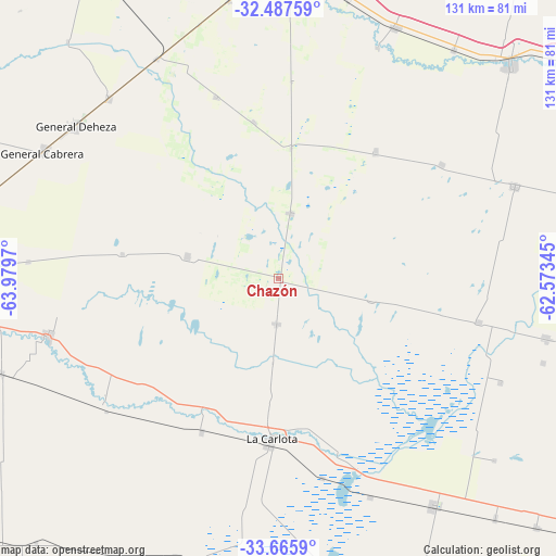
Chazón GPS coordinates[2]
33° 4' 43.392" South, 63° 16' 35.652" West
| Map corner | latitude | longitude |
|---|---|---|
| Upper-left | -32.48759°, | -63.9797° |
| Center: | -33.07872°, | -63.27657° |
| Lower-right: | -33.6659°, | -62.57345° |
| Map W x H: | 131×131 km | = 81.4×81.4mi |
| max Lat: | -21.94467° ⇑62.9% North |
| Chazón: | -33.07872° |
| min Lat: | ⇓37.1% South -54.81084° |
| min Long | Chazón | max Long |
| -72.88605° | -63.27657° | -53.64581° |
| W 46.1%⇐ | ⇒53.9% E |
Elevation
Elevation of Chazón is 164 m = 538 ft, and this is 185.3 m = 608 ft below average elevation for this country.
| Max E: |
4040 m = 13255 ft | 46.7% |
| Avg. | 349.3 m = 1146 ft | |
| Chazón | 164 m = 538 ft | |
Min E: |
-2 m = -7 ft | 53.3% |
See also: Argentina elevation on elevation.city.
Geographical zone
Chazón is located in South temperate zone (between Tropic of Capricorn and the Antarctic Circle). Distance of this Southern Tropic circle is 1072.1 km =666.2 mi to North.| Distance of | km | miles | from Chazón |
|---|---|---|---|
| Equator | 3678 | 2285.4 | to North |
| Tropic Capricorn | 1072.1 | 666.2 | to North |
| Antarctic Circle | 3723.2 | 2313.5 | to South |
| South Pole | 6329.1 | 3932.7 | to South |


Nearby cities:
15 places around Chazón: (largest is in red/bold)
• Alejandro Roca
51.2 km =31.8 mi,  233°
233°
• Dalmacio Vélez Sársfield
59.3 km =36.8 mi,  331°
331°
• Etruria
15.7 km =9.8 mi,  10°
10°
• Idiazábal
37.2 km =23.1 mi,  37°
37°
• La Carlota
38 km =23.6 mi,  182°
182°
• Laborde
40 km =24.9 mi,  101°
101°
• Las Perdices
58.3 km =36.2 mi,  316°
316°
• Ordóñez
46.6 km =29 mi,  55°
55°
• Pascanas
22.6 km =14 mi, 103°
• Pasco
37.4 km =23.2 mi,  350°
350°
• Santa Eufemia
10.9 km =6.8 mi, 183°
• Ticino
45.3 km =28.1 mi,  340°
340°
• Ucacha
22.1 km =13.7 mi,  283°
283°
• Villa Reducción
56.2 km =34.9 mi,  255°
255°
• Wenceslao Escalante
48.3 km =30 mi, 102°
Sources, notices
• [Note1] Compared only with cities in Argentina existing in our database
• [Src1] Map data: © OpenStreetMap contributors (CC-BY-SA)
• [Src2] Other city data from geonames.org with taken over terms of usage.
• [Src3] Geographical zone / Annual Mean Temperature by Robert A. Rohde @ Wikipedia
