La Carlota geodata
La Carlota (Cordoba) is a seat of a second-order administrative division; located in Argentina in America/Argentina/Cordoba (GMT-3) time zone. With population of 11,490 people, there are 266 cities with bigger population in this country. Compared to other cities in Argentina, 65.9% of cities are located further ↑North; 54.1% of cities are located further →East and 50.4% of cities have lower elevation than La Carlota. Note1


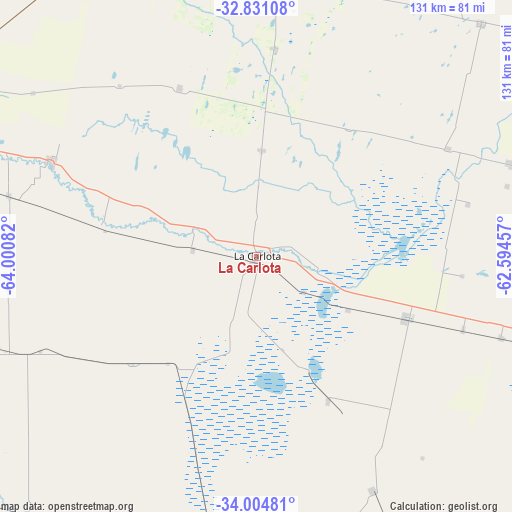
La Carlota GPS coordinates[2]
33° 25' 11.748" South, 63° 17' 51.684" West
| Map corner | latitude | longitude |
|---|---|---|
| Upper-left | -32.83108°, | -64.00082° |
| Center: | -33.41993°, | -63.29769° |
| Lower-right: | -34.00481°, | -62.59457° |
| Map W x H: | 130.5×130.5 km | = 81.1×81.1mi |
| max Lat: | -21.94467° ⇑65.9% North |
| La Carlota: | -33.41993° |
| min Lat: | ⇓34.1% South -54.81084° |
| min Long | La Carlota | max Long |
| -72.88605° | -63.29769° | -53.64581° |
| W 45.9%⇐ | ⇒54.1% E |
Elevation
Elevation of La Carlota is 147 m = 482 ft, and this is 202.3 m = 664 ft below average elevation for this country.
| Max E: |
4040 m = 13255 ft | 49.6% |
| Avg. | 349.3 m = 1146 ft | |
| La Carlota | 147 m = 482 ft | |
Min E: |
-2 m = -7 ft | 50.4% |
See also: Argentina elevation on elevation.city.
Geographical zone
La Carlota is located in South temperate zone (between Tropic of Capricorn and the Antarctic Circle). Distance of this Southern Tropic circle is 1110 km =689.7 mi to North.| Distance of | km | miles | from La Carlota |
|---|---|---|---|
| Equator | 3715.9 | 2309 | to North |
| Tropic Capricorn | 1110 | 689.7 | to North |
| Antarctic Circle | 3685.2 | 2289.9 | to South |
| South Pole | 6291.1 | 3909.1 | to South |


Nearby cities:
15 places around La Carlota: (largest is in red/bold)
• Alejandro Roca
39.8 km =24.7 mi,  280°
280°
• Alejo Ledesma
65.9 km =40.9 mi,  108°
108°
• Canals
41.2 km =25.6 mi, 113°
• Chazón
38 km =23.6 mi,  2°
2°
• Etruria
53.6 km =33.3 mi,  5°
5°
• Huanchillas
41.7 km =25.9 mi,  228°
228°
• La Cesira
66.3 km =41.2 mi,  152°
152°
• Laborde
50.6 km =31.4 mi,  54°
54°
• Las Acequias
64.9 km =40.3 mi, 283°
• Pascanas
40.5 km =25.2 mi,  36°
36°
• Santa Eufemia
27.1 km =16.8 mi, 2°
• Ucacha
47.3 km =29.4 mi,  335°
335°
• Viamonte
40.8 km =25.4 mi, 152°
• Villa Reducción
57.8 km =35.9 mi,  294°
294°
• Wenceslao Escalante
56.1 km =34.9 mi,  60°
60°
Sources, notices
• [Note1] Compared only with cities in Argentina existing in our database
• [Src1] Map data: © OpenStreetMap contributors (CC-BY-SA)
• [Src2] Other city data from geonames.org with taken over terms of usage.
• [Src3] Geographical zone / Annual Mean Temperature by Robert A. Rohde @ Wikipedia
