Bahía Blanca geodata
Bahía Blanca (Buenos Aires) is a seat of a second-order administrative division; located in Argentina in America/Argentina/Buenos_Aires (GMT-3) time zone. With population of 276,546 people, there are 16 cities with bigger population in this country. Compared to other cities in Argentina, 90.1% of cities are located further ↑North; 53.7% of cities are located further ←West and 92.6% of cities have higher elevation than Bahía Blanca. Note1


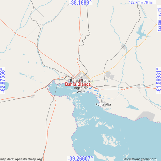
Bahía Blanca GPS coordinates[2]
38° 43' 10.524" South, 62° 16' 20.748" West
| Map corner | latitude | longitude |
|---|---|---|
| Upper-left | -38.1689°, | -62.97556° |
| Center: | -38.71959°, | -62.27243° |
| Lower-right: | -39.26607°, | -61.56931° |
| Map W x H: | 122×122 km | = 75.8×75.8mi |
| max Lat: | -21.94467° ⇑90.1% North |
| Bahía Blanca: | -38.71959° |
| min Lat: | ⇓9.9% South -54.81084° |
| min Long | Bahía Blanca | max Long |
| -72.88605° | -62.27243° | -53.64581° |
| W 53.7%⇐ | ⇒46.3% E |
Elevation
Elevation of Bahía Blanca is 24 m = 79 ft, and this is 325.3 m = 1067 ft below average elevation for this country.
| Max E: |
4040 m = 13255 ft | 92.6% |
| Avg. | 349.3 m = 1146 ft | |
| Bahía Blanca | 24 m = 79 ft | |
Min E: |
-2 m = -7 ft | 7.4% |
See also: Bahía Blanca elevation on elevation.city.
Geographical zone
Bahía Blanca is located in South temperate zone (between Tropic of Capricorn and the Antarctic Circle). Distance of this Southern Tropic circle is 1699.3 km =1055.9 mi to North.| Distance of | km | miles | from Bahía Blanca |
|---|---|---|---|
| Equator | 4305.2 | 2675.1 | to North |
| Tropic Capricorn | 1699.3 | 1055.9 | to North |
| Antarctic Circle | 3096 | 1923.8 | to South |
| South Pole | 5701.8 | 3542.9 | to South |


Nearby cities:
15 places around Bahía Blanca: (largest is in red/bold)
• Bernasconi
157 km =97.6 mi,  305°
305°
• Coronel Dorrego
85.5 km =53.1 mi,  89°
89°
• Coronel Pringles
114.4 km =71.1 mi,  44°
44°
• Coronel Suárez
143.7 km =89.3 mi,  11°
11°
• General San Martín
142.4 km =88.5 mi, 305°
• Guatraché
160.5 km =99.7 mi,  316°
316°
• Jacinto Arauz
123.1 km =76.5 mi,  304°
304°
• La Adela
159.5 km =99.1 mi,  259°
259°
• Monte Hermoso
89.6 km =55.7 mi,  109°
109°
• Médanos
38.4 km =23.9 mi,  251°
251°
• Pigüé
124.4 km =77.3 mi,  354°
354°
• Puan
137.5 km =85.4 mi,  341°
341°
• Punta Alta
24.5 km =15.2 mi,  135°
135°
• Río Colorado
160.6 km =99.8 mi, 259°
• Tornquist
68.9 km =42.8 mi,  3°
3°
Sources, notices
• [Note1] Compared only with cities in Argentina existing in our database
• [Src1] Map data: © OpenStreetMap contributors (CC-BY-SA)
• [Src2] Other city data from geonames.org with taken over terms of usage.
• [Src3] Geographical zone / Annual Mean Temperature by Robert A. Rohde @ Wikipedia
