Guatraché geodata
Guatraché (La Pampa) is a seat of a second-order administrative division; located in Argentina in America/Argentina/Salta (GMT-3) time zone. With population of 5,271 people, there are 435 cities with bigger population in this country. Compared to other cities in Argentina, 87.9% of cities are located further ↑North; 55.9% of cities are located further →East and 55.2% of cities have lower elevation than Guatraché. Note1


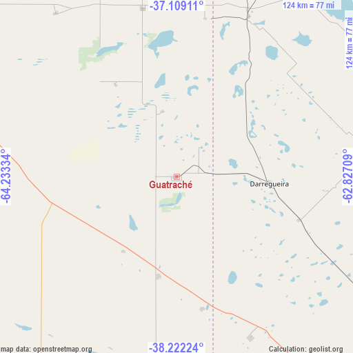
Guatraché GPS coordinates[2]
37° 40' 3.936" South, 63° 31' 48.756" West
| Map corner | latitude | longitude |
|---|---|---|
| Upper-left | -37.10911°, | -64.23334° |
| Center: | -37.66776°, | -63.53021° |
| Lower-right: | -38.22224°, | -62.82709° |
| Map W x H: | 123.8×123.8 km | = 76.9×76.9mi |
| max Lat: | -21.94467° ⇑87.9% North |
| Guatraché: | -37.66776° |
| min Lat: | ⇓12.1% South -54.81084° |
| min Long | Guatraché | max Long |
| -72.88605° | -63.53021° | -53.64581° |
| W 44.1%⇐ | ⇒55.9% E |
Elevation
Elevation of Guatraché is 174 m = 571 ft, and this is 175.3 m = 575 ft below average elevation for this country.
| Max E: |
4040 m = 13255 ft | 44.8% |
| Avg. | 349.3 m = 1146 ft | |
| Guatraché | 174 m = 571 ft | |
Min E: |
-2 m = -7 ft | 55.2% |
See also: Argentina elevation on elevation.city.
Geographical zone
Guatraché is located in South temperate zone (between Tropic of Capricorn and the Antarctic Circle). Distance of this Southern Tropic circle is 1582.3 km =983.2 mi to North.| Distance of | km | miles | from Guatraché |
|---|---|---|---|
| Equator | 4188.3 | 2602.5 | to North |
| Tropic Capricorn | 1582.3 | 983.2 | to North |
| Antarctic Circle | 3212.9 | 1996.4 | to South |
| South Pole | 5818.8 | 3615.6 | to South |


Nearby cities:
15 places around Guatraché: (largest is in red/bold)
• Alpachiri
38.8 km =24.1 mi,  326°
326°
• Ataliva Roca
97.2 km =60.4 mi,  316°
316°
• Bernasconi
32.3 km =20.1 mi,  215°
215°
• Carhué
87.4 km =54.3 mi,  51°
51°
• Doblas
71.6 km =44.5 mi, 323°
• General Acha
100.1 km =62.2 mi,  288°
288°
• General Manuel J. Campos
23.6 km =14.7 mi,  348°
348°
• General San Martín
35.2 km =21.9 mi,  190°
190°
• Guaminí
122.2 km =75.9 mi, 53°
• Jacinto Arauz
47.3 km =29.4 mi,  169°
169°
• Macachín
60.3 km =37.5 mi, 348°
• Miguel Riglos
91.6 km =56.9 mi, 351°
• Pigüé
99.5 km =61.8 mi,  85°
85°
• Puan
68.6 km =42.6 mi,  78°
78°
• Salliqueló
113.6 km =70.6 mi,  26°
26°
Sources, notices
• [Note1] Compared only with cities in Argentina existing in our database
• [Src1] Map data: © OpenStreetMap contributors (CC-BY-SA)
• [Src2] Other city data from geonames.org with taken over terms of usage.
• [Src3] Geographical zone / Annual Mean Temperature by Robert A. Rohde @ Wikipedia
