Bernasconi geodata
Bernasconi (La Pampa) is a seat of a second-order administrative division; located in Argentina in America/Argentina/Salta (GMT-3) time zone. With population of 1,781 people, there are 664 cities with bigger population in this country. Compared to other cities in Argentina, 88.4% of cities are located further ↑North; 58.3% of cities are located further →East and 53.3% of cities have lower elevation than Bernasconi. Note1


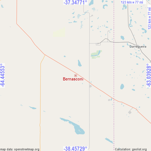
Bernasconi GPS coordinates[2]
37° 54' 16.524" South, 63° 44' 32.64" West
| Map corner | latitude | longitude |
|---|---|---|
| Upper-left | -37.34771°, | -64.44553° |
| Center: | -37.90459°, | -63.7424° |
| Lower-right: | -38.45729°, | -63.03928° |
| Map W x H: | 123.4×123.4 km | = 76.7×76.7mi |
| max Lat: | -21.94467° ⇑88.4% North |
| Bernasconi: | -37.90459° |
| min Lat: | ⇓11.6% South -54.81084° |
| min Long | Bernasconi | max Long |
| -72.88605° | -63.7424° | -53.64581° |
| W 41.7%⇐ | ⇒58.3% E |
Elevation
Elevation of Bernasconi is 164 m = 538 ft, and this is 185.3 m = 608 ft below average elevation for this country.
| Max E: |
4040 m = 13255 ft | 46.7% |
| Avg. | 349.3 m = 1146 ft | |
| Bernasconi | 164 m = 538 ft | |
Min E: |
-2 m = -7 ft | 53.3% |
See also: Argentina elevation on elevation.city.
Geographical zone
Bernasconi is located in South temperate zone (between Tropic of Capricorn and the Antarctic Circle). Distance of this Southern Tropic circle is 1608.7 km =999.6 mi to North.| Distance of | km | miles | from Bernasconi |
|---|---|---|---|
| Equator | 4214.6 | 2618.8 | to North |
| Tropic Capricorn | 1608.7 | 999.6 | to North |
| Antarctic Circle | 3186.6 | 1980.1 | to South |
| South Pole | 5792.5 | 3599.3 | to South |


Nearby cities:
15 places around Bernasconi: (largest is in red/bold)
• Alpachiri
58.7 km =36.5 mi,  357°
357°
• Ataliva Roca
108.2 km =67.2 mi,  333°
333°
• Carhué
118.7 km =73.8 mi,  47°
47°
• Cuchillo Có
92.1 km =57.2 mi,  238°
238°
• Doblas
87.2 km =54.2 mi,  344°
344°
• General Acha
95.9 km =59.6 mi,  307°
307°
• General Manuel J. Campos
51.3 km =31.9 mi,  15°
15°
• General San Martín
14.7 km =9.1 mi,  124°
124°
• Guatraché
32.3 km =20.1 mi,  35°
35°
• Jacinto Arauz
33.9 km =21.1 mi,  126°
126°
• La Adela
123.6 km =76.8 mi,  193°
193°
• Macachín
85.7 km =53.3 mi,  4°
4°
• Miguel Riglos
116.9 km =72.6 mi, 2°
• Pigüé
122.3 km =76 mi,  74°
74°
• Puan
94.6 km =58.8 mi, 65°
Sources, notices
• [Note1] Compared only with cities in Argentina existing in our database
• [Src1] Map data: © OpenStreetMap contributors (CC-BY-SA)
• [Src2] Other city data from geonames.org with taken over terms of usage.
• [Src3] Geographical zone / Annual Mean Temperature by Robert A. Rohde @ Wikipedia
