Würnitz geodata
Würnitz (Lower Austria) is a populated place; located in Austria in Europe/Vienna (GMT+2) time zone. With population of 920 people, there are 1398 cities with bigger population in this country. Compared to other cities in Austria, 91.3% of cities are located further ↓South; 91.7% of cities are located further ←West and 81% of cities have higher elevation than Würnitz. Note1
Administrative division(s):
- Level 1: Lower Austria
- Level 2: Politischer Bezirk Korneuburg
- Level 3: Harmannsdorf


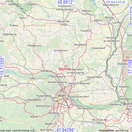
Würnitz GPS coordinates[2]
48° 25' 0.012" North, 16° 25' 0.012" East
| Map corner | latitude | longitude |
|---|---|---|
| Upper-left | 48.8812°, | 15.71355° |
| Center: | 48.41667°, | 16.41667° |
| Lower-right: | 47.94786°, | 17.1198° |
| Map W x H: | 103.8×103.8 km | = 64.5×64.5mi |
| max Lat: | 48.98333° ⇑8.7% North |
| Würnitz: | 48.41667° |
| min Lat: | ⇓91.3% South 46.48841° |
| min Long | Würnitz | max Long |
| 9.57802° | 16.41667° | 17.1° |
| W 91.7%⇐ | ⇒8.3% E |
Elevation
Elevation of Würnitz is 270 m = 886 ft, and this is 235.5 m = 773 ft below average elevation for this country.
| Max E: |
2140 m = 7021 ft | 81% |
| Avg. | 505.5 m = 1658 ft | |
| Würnitz | 270 m = 886 ft | |
Min E: |
118 m = 387 ft | 19% |
See also: Austria elevation on elevation.city.
Geographical zone
Würnitz is located in North temperate zone (between Tropic of Cancer and the Arctic Circle). Distance of this North polar circle is 2017.7 km =1253.7 mi to North.| Distance of | km | miles | from Würnitz |
|---|---|---|---|
| North Pole | 4623.6 | 2873 | to North |
| Arctic Circle | 2017.7 | 1253.7 | to North |
| Tropic Cancer | 2777.5 | 1725.9 | to South |
| Equator | 5383.4 | 3345.1 | to South |


Nearby cities:
15 places around Würnitz: (largest is in red/bold)
• Enzersfeld
5.9 km =3.7 mi,  174°
174°
• Großebersdorf
7.1 km =4.4 mi,  145°
145°
• Großrußbach
6.4 km =4 mi,  359°
359°
• Harmannsdorf
3.9 km =2.4 mi,  236°
236°
• Hautzendorf
5.3 km =3.3 mi,  69°
69°
• Königsbrunn im Weinviertel
7.7 km =4.8 mi,  184°
184°
• Münichsthal
5.2 km =3.2 mi,  135°
135°
• Niederkreuzstetten
8.1 km =5 mi,  33°
33°
• Obergänserndorf
3.7 km =2.3 mi,  270°
270°
• Rückersdorf
4.3 km =2.7 mi,  232°
232°
• Schleinbach
3.7 km =2.3 mi,  90°
90°
• Stetten
6.1 km =3.8 mi,  203°
203°
• Tresdorf
6.2 km =3.9 mi, 233°
• Ulrichskirchen
5.3 km =3.3 mi,  110°
110°
• Unterolberndorf
5.3 km =3.3 mi, 69°
Sources, notices
• [Note1] Compared only with cities in Austria existing in our database
• [Src1] Map data: © OpenStreetMap contributors (CC-BY-SA)
• [Src2] Other city data from geonames.org with taken over terms of usage.
• [Src3] Geographical zone / Annual Mean Temperature by Robert A. Rohde @ Wikipedia
