Winzendorf geodata
Winzendorf (Lower Austria) is a populated place; located in Austria in Europe/Vienna (GMT+2) time zone. With population of 1,282 people, there are 984 cities with bigger population in this country. Compared to other cities in Austria, 57.5% of cities are located further ↓South; 83.5% of cities are located further ←West and 69.9% of cities have higher elevation than Winzendorf. Note1
Administrative division(s):
- Level 1: Lower Austria
- Level 2: Politischer Bezirk Wiener Neustadt
- Level 3: Winzendorf-Muthmannsdorf


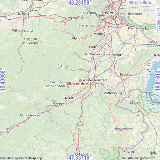
Winzendorf GPS coordinates[2]
47° 48' 41.544" North, 16° 6' 46.8" East
| Map corner | latitude | longitude |
|---|---|---|
| Upper-left | 48.28159°, | 15.40988° |
| Center: | 47.81154°, | 16.113° |
| Lower-right: | 47.33719°, | 16.81613° |
| Map W x H: | 105×105 km | = 65.2×65.2mi |
| max Lat: | 48.98333° ⇑42.5% North |
| Winzendorf: | 47.81154° |
| min Lat: | ⇓57.5% South 46.48841° |
| min Long | Winzendorf | max Long |
| 9.57802° | 16.113° | 17.1° |
| W 83.5%⇐ | ⇒16.5% E |
Elevation
Elevation of Winzendorf is 328 m = 1076 ft, and this is 177.5 m = 582 ft below average elevation for this country.
| Max E: |
2140 m = 7021 ft | 69.9% |
| Avg. | 505.5 m = 1658 ft | |
| Winzendorf | 328 m = 1076 ft | |
Min E: |
118 m = 387 ft | 30.1% |
See also: Austria elevation on elevation.city.
Geographical zone
Winzendorf is located in North temperate zone (between Tropic of Cancer and the Arctic Circle). Distance of this North polar circle is 2085 km =1295.6 mi to North.| Distance of | km | miles | from Winzendorf |
|---|---|---|---|
| North Pole | 4690.9 | 2914.8 | to North |
| Arctic Circle | 2085 | 1295.6 | to North |
| Tropic Cancer | 2710.2 | 1684 | to South |
| Equator | 5316.1 | 3303.3 | to South |


Nearby cities:
15 places around Winzendorf: (largest is in red/bold)
• Bad Fischau
4.6 km =2.9 mi,  61°
61°
• Brunn an der Schneebergbahn
3.7 km =2.3 mi,  68°
68°
• Dreistetten
5 km =3.1 mi,  349°
349°
• Maiersdorf
4.4 km =2.7 mi,  280°
280°
• Markt Piesting
7 km =4.3 mi,  7°
7°
• Mollram
6.1 km =3.8 mi,  195°
195°
• Muthmannsdorf
2.9 km =1.8 mi,  355°
355°
• Oberpiesting
7.2 km =4.5 mi, 351°
• Saubersdorf
2.5 km =1.6 mi,  170°
170°
• Stollhof
3.8 km =2.4 mi,  303°
303°
• Waldegg
7.8 km =4.8 mi,  324°
324°
• Weikersdorf am Steinfelde
2.4 km =1.5 mi,  104°
104°
• Willendorf am Steinfelde
4.9 km =3 mi,  239°
239°
• Wöllersdorf
7.4 km =4.6 mi,  36°
36°
• Würflach
5.8 km =3.6 mi,  228°
228°
Sources, notices
• [Note1] Compared only with cities in Austria existing in our database
• [Src1] Map data: © OpenStreetMap contributors (CC-BY-SA)
• [Src2] Other city data from geonames.org with taken over terms of usage.
• [Src3] Geographical zone / Annual Mean Temperature by Robert A. Rohde @ Wikipedia
