Würflach geodata
Würflach (Lower Austria) is a seat of a third-order administrative division; located in Austria in Europe/Vienna (GMT+2) time zone. With population of 1,009 people, there are 1278 cities with bigger population in this country. Compared to other cities in Austria, 56.3% of cities are located further ↓South; 81.8% of cities are located further ←West and 57.5% of cities have higher elevation than Würflach. Note1
Administrative division(s):
- Level 1: Lower Austria
- Level 2: Politischer Bezirk Neunkirchen
- Level 3: Würflach


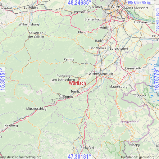
Würflach GPS coordinates[2]
47° 46' 35.328" North, 16° 3' 16.668" East
| Map corner | latitude | longitude |
|---|---|---|
| Upper-left | 48.24685°, | 15.35151° |
| Center: | 47.77648°, | 16.05463° |
| Lower-right: | 47.30181°, | 16.75776° |
| Map W x H: | 105.1×105.1 km | = 65.3×65.3mi |
| max Lat: | 48.98333° ⇑43.7% North |
| Würflach: | 47.77648° |
| min Lat: | ⇓56.3% South 46.48841° |
| min Long | Würflach | max Long |
| 9.57802° | 16.05463° | 17.1° |
| W 81.8%⇐ | ⇒18.2% E |
Elevation
Elevation of Würflach is 401 m = 1316 ft, and this is 104.5 m = 343 ft below average elevation for this country.
| Max E: |
2140 m = 7021 ft | 57.5% |
| Avg. | 505.5 m = 1658 ft | |
| Würflach | 401 m = 1316 ft | |
Min E: |
118 m = 387 ft | 42.5% |
See also: Austria elevation on elevation.city.
Geographical zone
Würflach is located in North temperate zone (between Tropic of Cancer and the Arctic Circle). Distance of this North polar circle is 2088.9 km =1298 mi to North.| Distance of | km | miles | from Würflach |
|---|---|---|---|
| North Pole | 4694.8 | 2917.2 | to North |
| Arctic Circle | 2088.9 | 1298 | to North |
| Tropic Cancer | 2706.3 | 1681.6 | to South |
| Equator | 5312.2 | 3300.8 | to South |


Nearby cities:
15 places around Würflach: (largest is in red/bold)
• Grünbach am Schneeberg
5.5 km =3.4 mi,  295°
295°
• Maiersdorf
4.7 km =2.9 mi,  0°
0°
• Mollram
3.4 km =2.1 mi,  126°
126°
• Muthmannsdorf
8 km =5 mi,  31°
31°
• Natschbach
7.9 km =4.9 mi,  155°
155°
• Neunkirchen
6.5 km =4 mi, 162°
• Peisching
7.1 km =4.4 mi,  142°
142°
• Raglitz
3 km =1.9 mi,  186°
186°
• Saubersdorf
5 km =3.1 mi,  73°
73°
• Schrattenbach
4.8 km =3 mi,  273°
273°
• Stollhof
6.1 km =3.8 mi,  10°
10°
• Ternitz
6.9 km =4.3 mi, 191°
• Weikersdorf am Steinfelde
7.4 km =4.6 mi,  63°
63°
• Willendorf am Steinfelde
1.4 km =0.9 mi, 6°
• Winzendorf
5.8 km =3.6 mi,  48°
48°
Sources, notices
• [Note1] Compared only with cities in Austria existing in our database
• [Src1] Map data: © OpenStreetMap contributors (CC-BY-SA)
• [Src2] Other city data from geonames.org with taken over terms of usage.
• [Src3] Geographical zone / Annual Mean Temperature by Robert A. Rohde @ Wikipedia
