Saubersdorf geodata
Saubersdorf (Lower Austria) is a populated place; located in Austria in Europe/Vienna (GMT+2) time zone. With population of 585 people, there are 2190 cities with bigger population in this country. Compared to other cities in Austria, 56.8% of cities are located further ↓South; 83.8% of cities are located further ←West and 71.5% of cities have higher elevation than Saubersdorf. Note1
Administrative division(s):
- Level 1: Lower Austria
- Level 2: Politischer Bezirk Neunkirchen
- Level 3: Sankt Egyden am Steinfeld


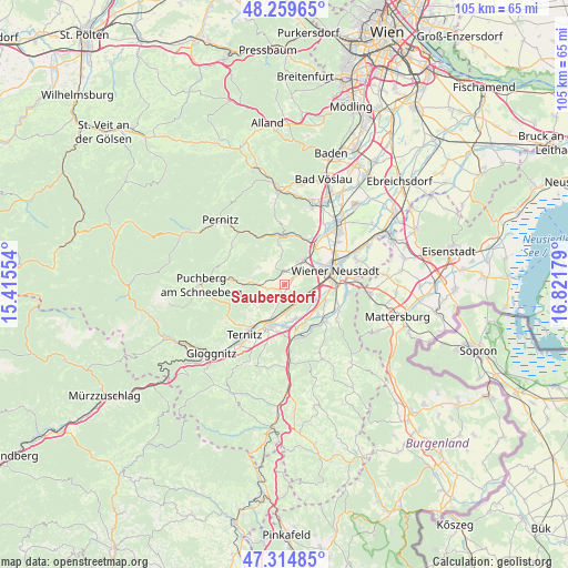
Saubersdorf GPS coordinates[2]
47° 47' 21.84" North, 16° 7' 7.176" East
| Map corner | latitude | longitude |
|---|---|---|
| Upper-left | 48.25965°, | 15.41554° |
| Center: | 47.7894°, | 16.11866° |
| Lower-right: | 47.31485°, | 16.82179° |
| Map W x H: | 105.1×105.1 km | = 65.3×65.3mi |
| max Lat: | 48.98333° ⇑43.2% North |
| Saubersdorf: | 47.7894° |
| min Lat: | ⇓56.8% South 46.48841° |
| min Long | Saubersdorf | max Long |
| 9.57802° | 16.11866° | 17.1° |
| W 83.8%⇐ | ⇒16.2% E |
Elevation
Elevation of Saubersdorf is 321 m = 1053 ft, and this is 184.5 m = 605 ft below average elevation for this country.
| Max E: |
2140 m = 7021 ft | 71.5% |
| Avg. | 505.5 m = 1658 ft | |
| Saubersdorf | 321 m = 1053 ft | |
Min E: |
118 m = 387 ft | 28.5% |
See also: Austria elevation on elevation.city.
Geographical zone
Saubersdorf is located in North temperate zone (between Tropic of Cancer and the Arctic Circle). Distance of this North polar circle is 2087.5 km =1297.1 mi to North.| Distance of | km | miles | from Saubersdorf |
|---|---|---|---|
| North Pole | 4693.4 | 2916.3 | to North |
| Arctic Circle | 2087.5 | 1297.1 | to North |
| Tropic Cancer | 2707.8 | 1682.5 | to South |
| Equator | 5313.7 | 3301.8 | to South |


Nearby cities:
15 places around Saubersdorf: (largest is in red/bold)
• Bad Fischau
5.9 km =3.7 mi,  37°
37°
• Breitenau
6.5 km =4 mi,  163°
163°
• Brunn an der Schneebergbahn
4.9 km =3 mi, 38°
• Dreistetten
7.5 km =4.7 mi,  349°
349°
• Maiersdorf
5.7 km =3.5 mi,  304°
304°
• Mollram
4 km =2.5 mi,  211°
211°
• Muthmannsdorf
5.4 km =3.4 mi, 353°
• Peisching
7.1 km =4.4 mi,  183°
183°
• Raglitz
6.7 km =4.2 mi,  229°
229°
• Schwarzau am Steinfeld
7.5 km =4.7 mi,  148°
148°
• Stollhof
5.8 km =3.6 mi,  321°
321°
• Weikersdorf am Steinfelde
2.6 km =1.6 mi,  45°
45°
• Willendorf am Steinfelde
4.6 km =2.9 mi,  269°
269°
• Winzendorf
2.5 km =1.6 mi, 350°
• Würflach
5 km =3.1 mi,  253°
253°
Sources, notices
• [Note1] Compared only with cities in Austria existing in our database
• [Src1] Map data: © OpenStreetMap contributors (CC-BY-SA)
• [Src2] Other city data from geonames.org with taken over terms of usage.
• [Src3] Geographical zone / Annual Mean Temperature by Robert A. Rohde @ Wikipedia
