Windorf geodata
Windorf (Styria) is a populated place; located in Austria in Europe/Vienna (GMT+2) time zone. With population of 641 people, there are 2006 cities with bigger population in this country. Compared to other cities in Austria, 84.6% of cities are located further ↑North; 62.7% of cities are located further ←West and 67.9% of cities have higher elevation than Windorf. Note1
Administrative division(s):
- Level 1: Styria
- Level 2: Politischer Bezirk Graz-Umgebung
- Level 3: Seiersberg-Pirka


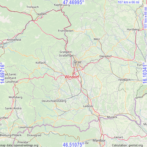
Windorf GPS coordinates[2]
46° 59' 33" North, 15° 24' 1.008" East
| Map corner | latitude | longitude |
|---|---|---|
| Upper-left | 47.46995°, | 14.69716° |
| Center: | 46.9925°, | 15.40028° |
| Lower-right: | 46.51075°, | 16.10341° |
| Map W x H: | 106.7×106.7 km | = 66.3×66.3mi |
| max Lat: | 48.98333° ⇑84.6% North |
| Windorf: | 46.9925° |
| min Lat: | ⇓15.4% South 46.48841° |
| min Long | Windorf | max Long |
| 9.57802° | 15.40028° | 17.1° |
| W 62.7%⇐ | ⇒37.3% E |
Elevation
Elevation of Windorf is 339 m = 1112 ft, and this is 166.5 m = 546 ft below average elevation for this country.
| Max E: |
2140 m = 7021 ft | 67.9% |
| Avg. | 505.5 m = 1658 ft | |
| Windorf | 339 m = 1112 ft | |
Min E: |
118 m = 387 ft | 32.1% |
See also: Austria elevation on elevation.city.
Geographical zone
Windorf is located in North temperate zone (between Tropic of Cancer and the Arctic Circle). Distance of this North polar circle is 2176.1 km =1352.2 mi to North.| Distance of | km | miles | from Windorf |
|---|---|---|---|
| North Pole | 4782 | 2971.4 | to North |
| Arctic Circle | 2176.1 | 1352.2 | to North |
| Tropic Cancer | 2619.2 | 1627.5 | to South |
| Equator | 5225.1 | 3246.7 | to South |


Nearby cities:
15 places around Windorf: (largest is in red/bold)
• Abtissendorf
4.3 km =2.7 mi,  85°
85°
• Attendorf
4.8 km =3 mi,  285°
285°
• Bierbaum
3.4 km =2.1 mi,  156°
156°
• Dörfla
5.1 km =3.2 mi,  80°
80°
• Feldkirchen bei Graz
4.6 km =2.9 mi,  54°
54°
• Hautzendorf
1 km =0.6 mi,  181°
181°
• Laa
4.9 km =3 mi,  165°
165°
• Lebern
3.9 km =2.4 mi, 77°
• Oberpremstätten
2 km =1.2 mi, 171°
• Pirka
1.5 km =0.9 mi,  302°
302°
• Seiersberg
0.8 km =0.5 mi,  358°
358°
• Spatenhof
4.5 km =2.8 mi,  221°
221°
• Straßgang
4.5 km =2.8 mi, 359°
• Unterpremstätten
3.1 km =1.9 mi, 174°
• Wagnitz
5.1 km =3.2 mi,  101°
101°
Sources, notices
• [Note1] Compared only with cities in Austria existing in our database
• [Src1] Map data: © OpenStreetMap contributors (CC-BY-SA)
• [Src2] Other city data from geonames.org with taken over terms of usage.
• [Src3] Geographical zone / Annual Mean Temperature by Robert A. Rohde @ Wikipedia
