Lebern geodata
Lebern (Styria) is a populated place; located in Austria in Europe/Vienna (GMT+2) time zone. With population of 964 people, there are 1346 cities with bigger population in this country. Compared to other cities in Austria, 84.4% of cities are located further ↑North; 63.9% of cities are located further ←West and 68.1% of cities have higher elevation than Lebern. Note1
Administrative division(s):
- Level 1: Styria
- Level 2: Politischer Bezirk Graz-Umgebung
- Level 3: Feldkirchen bei Graz


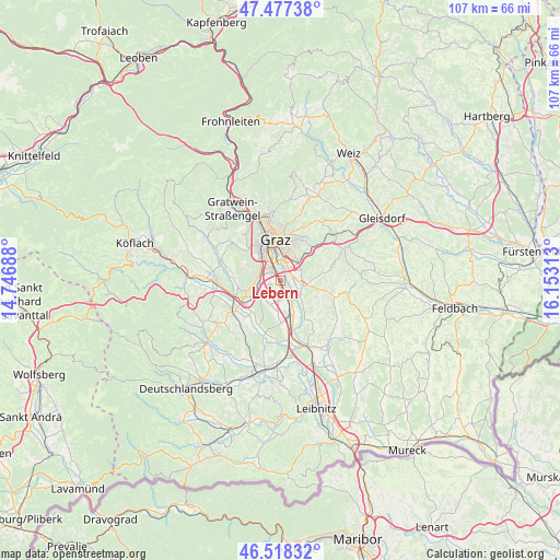
Lebern GPS coordinates[2]
47° 0' 0" North, 15° 27' 0" East
| Map corner | latitude | longitude |
|---|---|---|
| Upper-left | 47.47738°, | 14.74688° |
| Center: | 47°, | 15.45° |
| Lower-right: | 46.51832°, | 16.15313° |
| Map W x H: | 106.6×106.6 km | = 66.2×66.2mi |
| max Lat: | 48.98333° ⇑84.4% North |
| Lebern: | 47° |
| min Lat: | ⇓15.6% South 46.48841° |
| min Long | Lebern | max Long |
| 9.57802° | 15.45° | 17.1° |
| W 63.9%⇐ | ⇒36.1% E |
Elevation
Elevation of Lebern is 338 m = 1109 ft, and this is 167.5 m = 550 ft below average elevation for this country.
| Max E: |
2140 m = 7021 ft | 68.1% |
| Avg. | 505.5 m = 1658 ft | |
| Lebern | 338 m = 1109 ft | |
Min E: |
118 m = 387 ft | 31.9% |
See also: Austria elevation on elevation.city.
Geographical zone
Lebern is located in North temperate zone (between Tropic of Cancer and the Arctic Circle). Distance of this North polar circle is 2175.3 km =1351.7 mi to North.| Distance of | km | miles | from Lebern |
|---|---|---|---|
| North Pole | 4781.2 | 2970.9 | to North |
| Arctic Circle | 2175.3 | 1351.7 | to North |
| Tropic Cancer | 2620 | 1628 | to South |
| Equator | 5225.9 | 3247.2 | to South |


Nearby cities:
15 places around Lebern: (largest is in red/bold)
• Abtissendorf
0.7 km =0.4 mi,  133°
133°
• Bierbaum
4.6 km =2.9 mi,  211°
211°
• Dörfla
1.3 km =0.8 mi,  90°
90°
• Feldkirchen bei Graz
1.9 km =1.2 mi,  0°
0°
• Grambach
4.4 km =2.7 mi,  68°
68°
• Gössendorf
2.7 km =1.7 mi, 94°
• Hautzendorf
4.2 km =2.6 mi,  243°
243°
• Kalsdorf bei Graz
4.5 km =2.8 mi,  149°
149°
• Liebenau
3.9 km =2.4 mi,  18°
18°
• Oberpremstätten
4.5 km =2.8 mi,  230°
230°
• Puntigam
3.9 km =2.4 mi,  341°
341°
• Seiersberg
3.8 km =2.4 mi,  270°
270°
• Thondorf
2.3 km =1.4 mi,  57°
57°
• Wagnitz
2.2 km =1.4 mi, 145°
• Windorf
3.9 km =2.4 mi,  257°
257°
Sources, notices
• [Note1] Compared only with cities in Austria existing in our database
• [Src1] Map data: © OpenStreetMap contributors (CC-BY-SA)
• [Src2] Other city data from geonames.org with taken over terms of usage.
• [Src3] Geographical zone / Annual Mean Temperature by Robert A. Rohde @ Wikipedia
