Spatenhof geodata
Spatenhof (Styria) is a populated place; located in Austria in Europe/Vienna (GMT+2) time zone. With population of 1,021 people, there are 1259 cities with bigger population in this country. Compared to other cities in Austria, 85.8% of cities are located further ↑North; 61.9% of cities are located further ←West and 65.2% of cities have higher elevation than Spatenhof. Note1
Administrative division(s):
- Level 1: Styria
- Level 2: Politischer Bezirk Graz-Umgebung
- Level 3: Lieboch


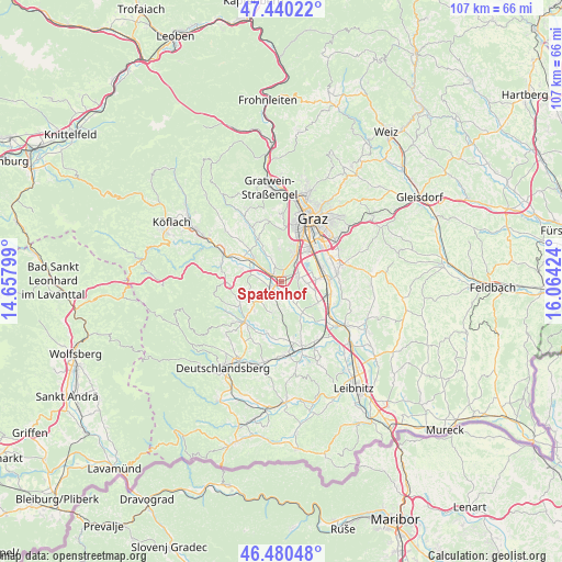
Spatenhof GPS coordinates[2]
46° 57' 45" North, 15° 21' 39.996" East
| Map corner | latitude | longitude |
|---|---|---|
| Upper-left | 47.44022°, | 14.65799° |
| Center: | 46.9625°, | 15.36111° |
| Lower-right: | 46.48048°, | 16.06424° |
| Map W x H: | 106.7×106.7 km | = 66.3×66.3mi |
| max Lat: | 48.98333° ⇑85.8% North |
| Spatenhof: | 46.9625° |
| min Lat: | ⇓14.2% South 46.48841° |
| min Long | Spatenhof | max Long |
| 9.57802° | 15.36111° | 17.1° |
| W 61.9%⇐ | ⇒38.1% E |
Elevation
Elevation of Spatenhof is 353 m = 1158 ft, and this is 152.5 m = 500 ft below average elevation for this country.
| Max E: |
2140 m = 7021 ft | 65.2% |
| Avg. | 505.5 m = 1658 ft | |
| Spatenhof | 353 m = 1158 ft | |
Min E: |
118 m = 387 ft | 34.8% |
See also: Austria elevation on elevation.city.
Geographical zone
Spatenhof is located in North temperate zone (between Tropic of Cancer and the Arctic Circle). Distance of this North polar circle is 2179.4 km =1354.2 mi to North.| Distance of | km | miles | from Spatenhof |
|---|---|---|---|
| North Pole | 4785.3 | 2973.4 | to North |
| Arctic Circle | 2179.4 | 1354.2 | to North |
| Tropic Cancer | 2615.8 | 1625.4 | to South |
| Equator | 5221.7 | 3244.6 | to South |


Nearby cities:
15 places around Spatenhof: (largest is in red/bold)
• Attendorf
4.9 km =3 mi,  340°
340°
• Bierbaum
4.3 km =2.7 mi,  86°
86°
• Blumegg
4.4 km =2.7 mi,  220°
220°
• Dobldorf
1.5 km =0.9 mi,  163°
163°
• Hautzendorf
3.8 km =2.4 mi,  51°
51°
• Laa
4.4 km =2.7 mi,  108°
108°
• Lannach
2.6 km =1.6 mi, 224°
• Lieboch
2.2 km =1.4 mi,  305°
305°
• Muttendorf
3.3 km =2.1 mi,  172°
172°
• Oberpremstätten
3.5 km =2.2 mi,  68°
68°
• Pirka
4.5 km =2.8 mi,  22°
22°
• Schadendorf
4 km =2.5 mi, 306°
• Seiersberg
5.1 km =3.2 mi,  35°
35°
• Unterpremstätten
3.3 km =2.1 mi, 85°
• Windorf
4.5 km =2.8 mi, 41°
Sources, notices
• [Note1] Compared only with cities in Austria existing in our database
• [Src1] Map data: © OpenStreetMap contributors (CC-BY-SA)
• [Src2] Other city data from geonames.org with taken over terms of usage.
• [Src3] Geographical zone / Annual Mean Temperature by Robert A. Rohde @ Wikipedia
