Gramatneusiedl geodata
Gramatneusiedl (Lower Austria) is a seat of a third-order administrative division; located in Austria in Europe/Vienna (GMT+2) time zone. With population of 3,461 people, there are 314 cities with bigger population in this country. Compared to other cities in Austria, 68.4% of cities are located further ↓South; 93.7% of cities are located further ←West and 95.1% of cities have higher elevation than Gramatneusiedl. Note1
Administrative division(s):
- Level 1: Lower Austria
- Level 2: Politischer Bezirk Bruck an der Leitha
- Level 3: Gramatneusiedl


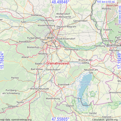
Gramatneusiedl GPS coordinates[2]
48° 1' 49.44" North, 16° 29' 21.696" East
| Map corner | latitude | longitude |
|---|---|---|
| Upper-left | 48.49846°, | 15.78624° |
| Center: | 48.0304°, | 16.48936° |
| Lower-right: | 47.55805°, | 17.19249° |
| Map W x H: | 104.6×104.6 km | = 65×65mi |
| max Lat: | 48.98333° ⇑31.6% North |
| Gramatneusiedl: | 48.0304° |
| min Lat: | ⇓68.4% South 46.48841° |
| min Long | Gramatneusiedl | max Long |
| 9.57802° | 16.48936° | 17.1° |
| W 93.7%⇐ | ⇒6.3% E |
Elevation
Elevation of Gramatneusiedl is 178 m = 584 ft, and this is 327.5 m = 1074 ft below average elevation for this country.
| Max E: |
2140 m = 7021 ft | 95.1% |
| Avg. | 505.5 m = 1658 ft | |
| Gramatneusiedl | 178 m = 584 ft | |
Min E: |
118 m = 387 ft | 4.9% |
See also: Austria elevation on elevation.city.
Geographical zone
Gramatneusiedl is located in North temperate zone (between Tropic of Cancer and the Arctic Circle). Distance of this North polar circle is 2060.7 km =1280.5 mi to North.| Distance of | km | miles | from Gramatneusiedl |
|---|---|---|---|
| North Pole | 4666.6 | 2899.7 | to North |
| Arctic Circle | 2060.7 | 1280.5 | to North |
| Tropic Cancer | 2734.6 | 1699.2 | to South |
| Equator | 5340.5 | 3318.4 | to South |


Nearby cities:
15 places around Gramatneusiedl: (largest is in red/bold)
• Ebergassing
2.7 km =1.7 mi,  50°
50°
• Götzendorf an der Leitha
7.2 km =4.5 mi,  102°
102°
• Himberg
7.2 km =4.5 mi,  324°
324°
• Margarethen am Moos
8.2 km =5.1 mi,  87°
87°
• Mitterndorf an der Fischa
3.9 km =2.4 mi,  197°
197°
• Moosbrunn
3.3 km =2.1 mi,  242°
242°
• Münchendorf
7.9 km =4.9 mi,  272°
272°
• Pellendorf
8 km =5 mi,  340°
340°
• Pischelsdorf
6.7 km =4.2 mi,  120°
120°
• Rauchenwarth
6.5 km =4 mi,  25°
25°
• Reisenberg
4.6 km =2.9 mi,  150°
150°
• Schwadorf
8 km =5 mi,  57°
57°
• Velm
4.2 km =2.6 mi, 274°
• Wasenbruck
7 km =4.3 mi,  133°
133°
• Wienerherberg
5.6 km =3.5 mi, 55°
Sources, notices
• [Note1] Compared only with cities in Austria existing in our database
• [Src1] Map data: © OpenStreetMap contributors (CC-BY-SA)
• [Src2] Other city data from geonames.org with taken over terms of usage.
• [Src3] Geographical zone / Annual Mean Temperature by Robert A. Rohde @ Wikipedia
