Weitendorf geodata
Weitendorf (Styria) is a populated place; located in Austria in Europe/Vienna (GMT+2) time zone. With population of 991 people, there are 1307 cities with bigger population in this country. Compared to other cities in Austria, 87.9% of cities are located further ↑North; 64.5% of cities are located further ←West and 74.6% of cities have higher elevation than Weitendorf. Note1


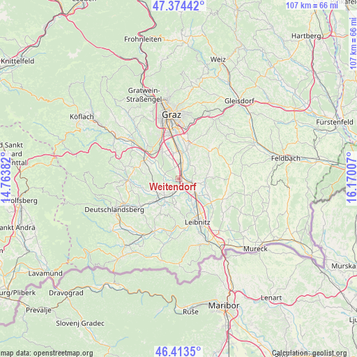
Weitendorf GPS coordinates[2]
46° 53' 45.996" North, 15° 28' 0.984" East
| Map corner | latitude | longitude |
|---|---|---|
| Upper-left | 47.37442°, | 14.76382° |
| Center: | 46.89611°, | 15.46694° |
| Lower-right: | 46.4135°, | 16.17007° |
| Map W x H: | 106.8×106.8 km | = 66.4×66.4mi |
| max Lat: | 48.98333° ⇑87.9% North |
| Weitendorf: | 46.89611° |
| min Lat: | ⇓12.1% South 46.48841° |
| min Long | Weitendorf | max Long |
| 9.57802° | 15.46694° | 17.1° |
| W 64.5%⇐ | ⇒35.5% E |
Elevation
Elevation of Weitendorf is 306 m = 1004 ft, and this is 199.5 m = 655 ft below average elevation for this country.
| Max E: |
2140 m = 7021 ft | 74.6% |
| Avg. | 505.5 m = 1658 ft | |
| Weitendorf | 306 m = 1004 ft | |
Min E: |
118 m = 387 ft | 25.4% |
See also: Austria elevation on elevation.city.
Geographical zone
Weitendorf is located in North temperate zone (between Tropic of Cancer and the Arctic Circle). Distance of this North polar circle is 2186.8 km =1358.8 mi to North.| Distance of | km | miles | from Weitendorf |
|---|---|---|---|
| North Pole | 4792.7 | 2978 | to North |
| Arctic Circle | 2186.8 | 1358.8 | to North |
| Tropic Cancer | 2608.4 | 1620.8 | to South |
| Equator | 5214.4 | 3240.1 | to South |


Nearby cities:
15 places around Weitendorf: (largest is in red/bold)
• Allerheiligen bei Wildon
6.9 km =4.3 mi,  73°
73°
• Grosssulz
5.8 km =3.6 mi,  17°
17°
• Hengsberg
4.2 km =2.6 mi,  217°
217°
• Kalsdorf bei Graz
7.8 km =4.8 mi,  7°
7°
• Laa
7.1 km =4.4 mi,  327°
327°
• Lang
7.1 km =4.4 mi,  156°
156°
• Lebring
7.3 km =4.5 mi,  131°
131°
• Mellach
5.6 km =3.5 mi,  42°
42°
• Preding
6 km =3.7 mi,  226°
226°
• Sankt Margarethen bei Lebring
5.9 km =3.7 mi, 128°
• Sankt Ulrich am Waasen
6.5 km =4 mi,  50°
50°
• Werndorf
3.6 km =2.2 mi,  30°
30°
• Wildon
4 km =2.5 mi,  110°
110°
• Wundschuh
3.6 km =2.2 mi,  340°
340°
• Zettling
6.7 km =4.2 mi, 338°
Sources, notices
• [Note1] Compared only with cities in Austria existing in our database
• [Src1] Map data: © OpenStreetMap contributors (CC-BY-SA)
• [Src2] Other city data from geonames.org with taken over terms of usage.
• [Src3] Geographical zone / Annual Mean Temperature by Robert A. Rohde @ Wikipedia
