Lebring geodata
Lebring (Styria) is a populated place; located in Austria in Europe/Vienna (GMT+2) time zone. With population of 990 people, there are 1309 cities with bigger population in this country. Compared to other cities in Austria, 89.5% of cities are located further ↑North; 66.6% of cities are located further ←West and 77.8% of cities have higher elevation than Lebring. Note1
Administrative division(s):
- Level 1: Styria
- Level 2: Politischer Bezirk Leibnitz
- Level 3: Lebring-Sankt Margarethen


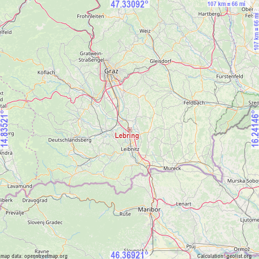
Lebring GPS coordinates[2]
46° 51' 7.992" North, 15° 32' 17.988" East
| Map corner | latitude | longitude |
|---|---|---|
| Upper-left | 47.33092°, | 14.83521° |
| Center: | 46.85222°, | 15.53833° |
| Lower-right: | 46.36921°, | 16.24146° |
| Map W x H: | 106.9×106.9 km | = 66.4×66.4mi |
| max Lat: | 48.98333° ⇑89.5% North |
| Lebring: | 46.85222° |
| min Lat: | ⇓10.5% South 46.48841° |
| min Long | Lebring | max Long |
| 9.57802° | 15.53833° | 17.1° |
| W 66.6%⇐ | ⇒33.4% E |
Elevation
Elevation of Lebring is 285 m = 935 ft, and this is 220.5 m = 723 ft below average elevation for this country.
| Max E: |
2140 m = 7021 ft | 77.8% |
| Avg. | 505.5 m = 1658 ft | |
| Lebring | 285 m = 935 ft | |
Min E: |
118 m = 387 ft | 22.2% |
See also: Austria elevation on elevation.city.
Geographical zone
Lebring is located in North temperate zone (between Tropic of Cancer and the Arctic Circle). Distance of this North polar circle is 2191.7 km =1361.9 mi to North.| Distance of | km | miles | from Lebring |
|---|---|---|---|
| North Pole | 4797.6 | 2981.1 | to North |
| Arctic Circle | 2191.7 | 1361.9 | to North |
| Tropic Cancer | 2603.6 | 1617.8 | to South |
| Equator | 5209.5 | 3237 | to South |


Nearby cities:
15 places around Lebring: (largest is in red/bold)
• Allerheiligen bei Wildon
7 km =4.3 mi,  10°
10°
• Breitenfeld am Tannenriegel
7.2 km =4.5 mi,  91°
91°
• Gralla
4.4 km =2.7 mi,  163°
163°
• Kaindorf an der Sulm
6.6 km =4.1 mi,  179°
179°
• Lang
3 km =1.9 mi,  237°
237°
• Leibnitz
7.9 km =4.9 mi, 179°
• Neutillmitsch
4 km =2.5 mi,  185°
185°
• Ragnitz
4.5 km =2.8 mi,  112°
112°
• Sankt Georgen an der Stiefing
3.9 km =2.4 mi,  53°
53°
• Sankt Margarethen bei Lebring
1.5 km =0.9 mi,  327°
327°
• Sankt Nikolai im Sausal
7.4 km =4.6 mi, 242°
• Tillmitsch
4.8 km =3 mi,  200°
200°
• Tillmitsch Links der Laßnitz
4.9 km =3 mi, 192°
• Weitendorf
7.3 km =4.5 mi,  311°
311°
• Wildon
3.8 km =2.4 mi, 334°
Sources, notices
• [Note1] Compared only with cities in Austria existing in our database
• [Src1] Map data: © OpenStreetMap contributors (CC-BY-SA)
• [Src2] Other city data from geonames.org with taken over terms of usage.
• [Src3] Geographical zone / Annual Mean Temperature by Robert A. Rohde @ Wikipedia
