Türkstetten geodata
Türkstetten (Upper Austria) is a populated place; located in Austria in Europe/Vienna (GMT+2) time zone. With population of 511 people, there are 2465 cities with bigger population in this country. Compared to other cities in Austria, 89.5% of cities are located further ↓South; 60.3% of cities are located further →East and 65.4% of cities have lower elevation than Türkstetten. Note1
Administrative division(s):
- Level 1: Upper Austria
- Level 2: Politischer Bezirk Urfahr-Umgebung
- Level 3: Gramastetten


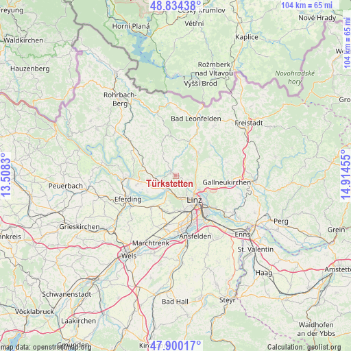
Türkstetten GPS coordinates[2]
48° 22' 9.912" North, 14° 12' 41.112" East
| Map corner | latitude | longitude |
|---|---|---|
| Upper-left | 48.83438°, | 13.5083° |
| Center: | 48.36942°, | 14.21142° |
| Lower-right: | 47.90017°, | 14.91455° |
| Map W x H: | 103.9×103.9 km | = 64.6×64.6mi |
| max Lat: | 48.98333° ⇑10.5% North |
| Türkstetten: | 48.36942° |
| min Lat: | ⇓89.5% South 46.48841° |
| min Long | Türkstetten | max Long |
| 9.57802° | 14.21142° | 17.1° |
| W 39.7%⇐ | ⇒60.3% E |
Elevation
Elevation of Türkstetten is 555 m = 1821 ft, and this is 49.5 m = 162 ft above average elevation for this country.
| Max E: |
2140 m = 7021 ft | 34.6% |
| Türkstetten | 555 m 1821 ft | |
| Avg. | 505.5 m = 1658 ft | |
Min E: |
118 m = 387 ft | 65.4% |
See also: Austria elevation on elevation.city.
Geographical zone
Türkstetten is located in North temperate zone (between Tropic of Cancer and the Arctic Circle). Distance of this North polar circle is 2023 km =1257 mi to North.| Distance of | km | miles | from Türkstetten |
|---|---|---|---|
| North Pole | 4628.9 | 2876.3 | to North |
| Arctic Circle | 2023 | 1257 | to North |
| Tropic Cancer | 2772.3 | 1722.6 | to South |
| Equator | 5378.2 | 3341.9 | to South |


Nearby cities:
15 places around Türkstetten: (largest is in red/bold)
• Altlichtenberg
3.6 km =2.2 mi,  106°
106°
• Dürnberg
3.7 km =2.3 mi,  186°
186°
• Edramsberg
6.9 km =4.3 mi,  203°
203°
• Eidenberg
3.2 km =2 mi,  30°
30°
• Gramastetten
1.9 km =1.2 mi,  309°
309°
• Kirchschlag bei Linz
6.7 km =4.2 mi,  45°
45°
• Mühlbach
7.4 km =4.6 mi, 194°
• Niederottensheim
3.9 km =2.4 mi,  209°
209°
• Ottensheim
4.9 km =3 mi, 213°
• Puchenau
6.6 km =4.1 mi,  163°
163°
• Sankt Gotthard im Mühlkreis
6 km =3.7 mi,  281°
281°
• Schönering
8.7 km =5.4 mi, 205°
• Unterpuchenau
4.9 km =3 mi, 159°
• Walding
4.4 km =2.7 mi,  244°
244°
• Zaubertal
7.9 km =4.9 mi, 156°
Sources, notices
• [Note1] Compared only with cities in Austria existing in our database
• [Src1] Map data: © OpenStreetMap contributors (CC-BY-SA)
• [Src2] Other city data from geonames.org with taken over terms of usage.
• [Src3] Geographical zone / Annual Mean Temperature by Robert A. Rohde @ Wikipedia
