Niederottensheim geodata
Niederottensheim (Upper Austria) is a populated place; located in Austria in Europe/Vienna (GMT+2) time zone. With population of 502 people, there are 2502 cities with bigger population in this country. Compared to other cities in Austria, 87.8% of cities are located further ↓South; 60.9% of cities are located further →East and 81% of cities have higher elevation than Niederottensheim. Note1
Administrative division(s):
- Level 1: Upper Austria
- Level 2: Politischer Bezirk Urfahr-Umgebung
- Level 3: Ottensheim


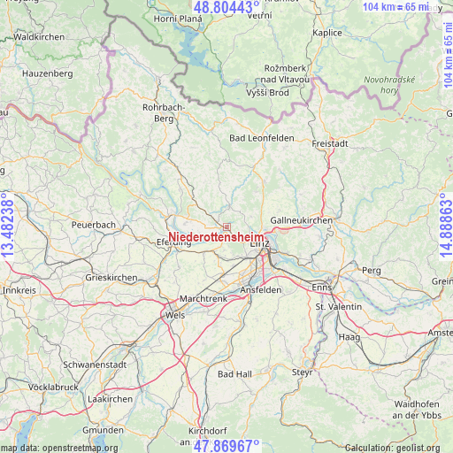
Niederottensheim GPS coordinates[2]
48° 20' 21.084" North, 14° 11' 7.8" East
| Map corner | latitude | longitude |
|---|---|---|
| Upper-left | 48.80443°, | 13.48238° |
| Center: | 48.33919°, | 14.1855° |
| Lower-right: | 47.86967°, | 14.88863° |
| Map W x H: | 103.9×103.9 km | = 64.6×64.6mi |
| max Lat: | 48.98333° ⇑12.2% North |
| Niederottensheim: | 48.33919° |
| min Lat: | ⇓87.8% South 46.48841° |
| min Long | Niederottenshei | max Long |
| 9.57802° | 14.1855° | 17.1° |
| W 39.1%⇐ | ⇒60.9% E |
Elevation
Elevation of Niederottensheim is 270 m = 886 ft, and this is 235.5 m = 773 ft below average elevation for this country.
| Max E: |
2140 m = 7021 ft | 81% |
| Avg. | 505.5 m = 1658 ft | |
| Niederottensheim | 270 m = 886 ft | |
Min E: |
118 m = 387 ft | 19% |
See also: Austria elevation on elevation.city.
Geographical zone
Niederottensheim is located in North temperate zone (between Tropic of Cancer and the Arctic Circle). Distance of this North polar circle is 2026.4 km =1259.1 mi to North.| Distance of | km | miles | from Niederottensheim |
|---|---|---|---|
| North Pole | 4632.2 | 2878.3 | to North |
| Arctic Circle | 2026.4 | 1259.1 | to North |
| Tropic Cancer | 2768.9 | 1720.5 | to South |
| Equator | 5374.8 | 3339.7 | to South |


Nearby cities:
15 places around Niederottensheim: (largest is in red/bold)
• Altlichtenberg
5.9 km =3.7 mi,  66°
66°
• Dürnberg
1.5 km =0.9 mi,  102°
102°
• Edramsberg
3.1 km =1.9 mi,  196°
196°
• Goldwörth
6.4 km =4 mi,  257°
257°
• Gramastetten
4.6 km =2.9 mi,  5°
5°
• Mühlbach
3.8 km =2.4 mi,  178°
178°
• Ottensheim
1.1 km =0.7 mi,  228°
228°
• Puchenau
4.8 km =3 mi,  128°
128°
• Reith
5.4 km =3.4 mi,  187°
187°
• Sankt Gotthard im Mühlkreis
6 km =3.7 mi,  319°
319°
• Schönering
4.9 km =3 mi, 201°
• Türkstetten
3.9 km =2.4 mi,  29°
29°
• Unterpuchenau
3.8 km =2.4 mi,  108°
108°
• Walding
2.5 km =1.6 mi,  304°
304°
• Zaubertal
6.4 km =4 mi, 127°
Sources, notices
• [Note1] Compared only with cities in Austria existing in our database
• [Src1] Map data: © OpenStreetMap contributors (CC-BY-SA)
• [Src2] Other city data from geonames.org with taken over terms of usage.
• [Src3] Geographical zone / Annual Mean Temperature by Robert A. Rohde @ Wikipedia
