Tadten geodata
Tadten (Burgenland) is a seat of a third-order administrative division; located in Austria in Europe/Vienna (GMT+2) time zone. With population of 1,186 people, there are 1061 cities with bigger population in this country. Compared to other cities in Austria, 55.8% of cities are located further ↓South; 99.7% of cities are located further ←West and 99.9% of cities have higher elevation than Tadten. Note1
Administrative division(s):
- Level 1: Burgenland
- Level 2: Politischer Bezirk Neusiedl am See
- Level 3: Tadten


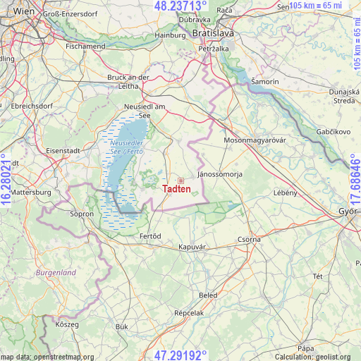
Tadten GPS coordinates[2]
47° 46' 0.012" North, 16° 58' 59.988" East
| Map corner | latitude | longitude |
|---|---|---|
| Upper-left | 48.23713°, | 16.28021° |
| Center: | 47.76667°, | 16.98333° |
| Lower-right: | 47.29192°, | 17.68646° |
| Map W x H: | 105.1×105.1 km | = 65.3×65.3mi |
| max Lat: | 48.98333° ⇑44.2% North |
| Tadten: | 47.76667° |
| min Lat: | ⇓55.8% South 46.48841° |
| min Long | Tadten | max Long |
| 9.57802° | 16.98333° | 17.1° |
| W 99.7%⇐ | ⇒0.3% E |
Elevation
Elevation of Tadten is 119 m = 390 ft, and this is 386.5 m = 1268 ft below average elevation for this country.
| Max E: |
2140 m = 7021 ft | 99.9% |
| Avg. | 505.5 m = 1658 ft | |
| Tadten | 119 m = 390 ft | |
Min E: |
118 m = 387 ft | 0.1% |
See also: Austria elevation on elevation.city.
Geographical zone
Tadten is located in North temperate zone (between Tropic of Cancer and the Arctic Circle). Distance of this North polar circle is 2090 km =1298.7 mi to North.| Distance of | km | miles | from Tadten |
|---|---|---|---|
| North Pole | 4695.9 | 2917.9 | to North |
| Arctic Circle | 2090 | 1298.7 | to North |
| Tropic Cancer | 2705.2 | 1680.9 | to South |
| Equator | 5311.2 | 3300.2 | to South |


Nearby cities:
15 places around Tadten: (largest is in red/bold)
• Andau
3.8 km =2.4 mi,  76°
76°
• Apetlon
11.7 km =7.3 mi,  257°
257°
• Frauenkirchen
8.9 km =5.5 mi,  331°
331°
• Gols
15.4 km =9.6 mi,  339°
339°
• Halbturn
11.5 km =7.1 mi,  357°
357°
• Illmitz
13.7 km =8.5 mi,  267°
267°
• Mönchhof
13 km =8.1 mi,  346°
346°
• Neusiedl am See
22.9 km =14.2 mi, 332°
• Nickelsdorf
20.4 km =12.7 mi,  18°
18°
• Pamhagen
9.2 km =5.7 mi,  217°
217°
• Podersdorf am See
14.6 km =9.1 mi,  311°
311°
• Rust
23.6 km =14.7 mi,  279°
279°
• Sankt Andrä am Zicksee
3.6 km =2.2 mi,  302°
302°
• Wallern im Burgenland
5.5 km =3.4 mi, 219°
• Weiden am See
19.6 km =12.2 mi, 334°
Sources, notices
• [Note1] Compared only with cities in Austria existing in our database
• [Src1] Map data: © OpenStreetMap contributors (CC-BY-SA)
• [Src2] Other city data from geonames.org with taken over terms of usage.
• [Src3] Geographical zone / Annual Mean Temperature by Robert A. Rohde @ Wikipedia
