Sankt Andrä am Zicksee geodata
Sankt Andrä am Zicksee (Burgenland) is a seat of a third-order administrative division; located in Austria in Europe/Vienna (GMT+2) time zone. With population of 1,371 people, there are 917 cities with bigger population in this country. Compared to other cities in Austria, 56.6% of cities are located further ↓South; 99.5% of cities are located further ←West and 99.7% of cities have higher elevation than Sankt Andrä am Zicksee. Note1
Administrative division(s):
- Level 1: Burgenland
- Level 2: Politischer Bezirk Neusiedl am See
- Level 3: Sankt Andrä am Zicksee


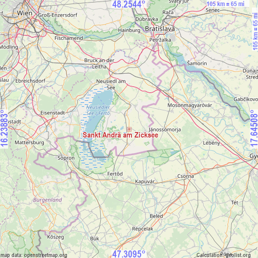
Sankt Andrä am Zicksee GPS coordinates[2]
47° 47' 2.76" North, 16° 56' 31.02" East
| Map corner | latitude | longitude |
|---|---|---|
| Upper-left | 48.2544°, | 16.23883° |
| Center: | 47.7841°, | 16.94195° |
| Lower-right: | 47.3095°, | 17.64508° |
| Map W x H: | 105.1×105.1 km | = 65.3×65.3mi |
| max Lat: | 48.98333° ⇑43.4% North |
| Sankt Andrä am Zicksee: | 47.7841° |
| min Lat: | ⇓56.6% South 46.48841° |
| min Long | Sankt Andrä am | max Long |
| 9.57802° | 16.94195° | 17.1° |
| W 99.5%⇐ | ⇒0.5% E |
Elevation
Elevation of Sankt Andrä am Zicksee is 124 m = 407 ft, and this is 381.5 m = 1252 ft below average elevation for this country.
| Max E: |
2140 m = 7021 ft | 99.7% |
| Avg. | 505.5 m = 1658 ft | |
| Sankt Andrä am Zicksee | 124 m = 407 ft | |
Min E: |
118 m = 387 ft | 0.3% |
See also: Austria elevation on elevation.city.
Geographical zone
Sankt Andrä am Zicksee is located in North temperate zone (between Tropic of Cancer and the Arctic Circle). Distance of this North polar circle is 2088.1 km =1297.5 mi to North.| Distance of | km | miles | from Sankt Andrä am Zicksee |
|---|---|---|---|
| North Pole | 4694 | 2916.7 | to North |
| Arctic Circle | 2088.1 | 1297.5 | to North |
| Tropic Cancer | 2707.2 | 1682.2 | to South |
| Equator | 5313.1 | 3301.4 | to South |


Nearby cities:
15 places around Sankt Andrä am Zicksee: (largest is in red/bold)
• Andau
6.9 km =4.3 mi,  99°
99°
• Apetlon
9.5 km =5.9 mi,  241°
241°
• Frauenkirchen
6 km =3.7 mi,  348°
348°
• Gols
12.8 km =8 mi, 349°
• Halbturn
9.9 km =6.2 mi,  14°
14°
• Illmitz
10.9 km =6.8 mi,  256°
256°
• Mönchhof
10.7 km =6.6 mi,  359°
359°
• Neusiedl am See
19.8 km =12.3 mi,  337°
337°
• Nickelsdorf
19.8 km =12.3 mi,  28°
28°
• Pamhagen
9.6 km =6 mi,  195°
195°
• Podersdorf am See
11 km =6.8 mi,  314°
314°
• Rust
20.3 km =12.6 mi,  275°
275°
• Tadten
3.6 km =2.2 mi,  122°
122°
• Wallern im Burgenland
6.2 km =3.9 mi,  183°
183°
• Weiden am See
16.6 km =10.3 mi, 340°
Sources, notices
• [Note1] Compared only with cities in Austria existing in our database
• [Src1] Map data: © OpenStreetMap contributors (CC-BY-SA)
• [Src2] Other city data from geonames.org with taken over terms of usage.
• [Src3] Geographical zone / Annual Mean Temperature by Robert A. Rohde @ Wikipedia
