Pamhagen geodata
Pamhagen (Burgenland) is a seat of a third-order administrative division; located in Austria in Europe/Vienna (GMT+2) time zone. With population of 1,623 people, there are 768 cities with bigger population in this country. Compared to other cities in Austria, 53.5% of cities are located further ↓South; 99.2% of cities are located further ←West and 99.8% of cities have higher elevation than Pamhagen. Note1
Administrative division(s):
- Level 1: Burgenland
- Level 2: Politischer Bezirk Neusiedl am See
- Level 3: Pamhagen


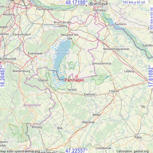
Pamhagen GPS coordinates[2]
47° 42' 3.312" North, 16° 54' 28.044" East
| Map corner | latitude | longitude |
|---|---|---|
| Upper-left | 48.17198°, | 16.20467° |
| Center: | 47.70092°, | 16.90779° |
| Lower-right: | 47.22557°, | 17.61092° |
| Map W x H: | 105.2×105.2 km | = 65.4×65.4mi |
| max Lat: | 48.98333° ⇑46.5% North |
| Pamhagen: | 47.70092° |
| min Lat: | ⇓53.5% South 46.48841° |
| min Long | Pamhagen | max Long |
| 9.57802° | 16.90779° | 17.1° |
| W 99.2%⇐ | ⇒0.8% E |
Elevation
Elevation of Pamhagen is 121 m = 397 ft, and this is 384.5 m = 1261 ft below average elevation for this country.
| Max E: |
2140 m = 7021 ft | 99.8% |
| Avg. | 505.5 m = 1658 ft | |
| Pamhagen | 121 m = 397 ft | |
Min E: |
118 m = 387 ft | 0.2% |
See also: Austria elevation on elevation.city.
Geographical zone
Pamhagen is located in North temperate zone (between Tropic of Cancer and the Arctic Circle). Distance of this North polar circle is 2097.3 km =1303.2 mi to North.| Distance of | km | miles | from Pamhagen |
|---|---|---|---|
| North Pole | 4703.2 | 2922.4 | to North |
| Arctic Circle | 2097.3 | 1303.2 | to North |
| Tropic Cancer | 2697.9 | 1676.4 | to South |
| Equator | 5303.8 | 3295.6 | to South |


Nearby cities:
15 places around Pamhagen: (largest is in red/bold)
• Andau
12.4 km =7.7 mi,  48°
48°
• Apetlon
7.5 km =4.7 mi,  309°
309°
• Deutschkreutz
23.4 km =14.5 mi,  241°
241°
• Frauenkirchen
15.2 km =9.4 mi,  5°
5°
• Gols
21.8 km =13.5 mi,  0°
0°
• Halbturn
19.5 km =12.1 mi,  15°
15°
• Illmitz
10.5 km =6.5 mi, 309°
• Mönchhof
20.1 km =12.5 mi, 7°
• Mörbisch am See
18.8 km =11.7 mi,  286°
286°
• Oggau
23.3 km =14.5 mi, 309°
• Podersdorf am See
17.8 km =11.1 mi,  342°
342°
• Rust
20.9 km =13 mi,  302°
302°
• Sankt Andrä am Zicksee
9.6 km =6 mi, 15°
• Tadten
9.2 km =5.7 mi,  37°
37°
• Wallern im Burgenland
3.8 km =2.4 mi, 35°
Sources, notices
• [Note1] Compared only with cities in Austria existing in our database
• [Src1] Map data: © OpenStreetMap contributors (CC-BY-SA)
• [Src2] Other city data from geonames.org with taken over terms of usage.
• [Src3] Geographical zone / Annual Mean Temperature by Robert A. Rohde @ Wikipedia
