Stetteldorf am Wagram geodata
Stetteldorf am Wagram (Lower Austria) is a seat of a third-order administrative division; located in Austria in Europe/Vienna (GMT+2) time zone. With population of 542 people, there are 2352 cities with bigger population in this country. Compared to other cities in Austria, 91.1% of cities are located further ↓South; 80.9% of cities are located further ←West and 90.8% of cities have higher elevation than Stetteldorf am Wagram. Note1
Administrative division(s):
- Level 1: Lower Austria
- Level 2: Politischer Bezirk Korneuburg
- Level 3: Stetteldorf am Wagram


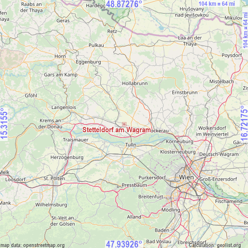
Stetteldorf am Wagram GPS coordinates[2]
48° 24' 29.34" North, 16° 1' 7.032" East
| Map corner | latitude | longitude |
|---|---|---|
| Upper-left | 48.87276°, | 15.3155° |
| Center: | 48.40815°, | 16.01862° |
| Lower-right: | 47.93926°, | 16.72175° |
| Map W x H: | 103.8×103.8 km | = 64.5×64.5mi |
| max Lat: | 48.98333° ⇑8.9% North |
| Stetteldorf am Wagram: | 48.40815° |
| min Lat: | ⇓91.1% South 46.48841° |
| min Long | Stetteldorf am | max Long |
| 9.57802° | 16.01862° | 17.1° |
| W 80.9%⇐ | ⇒19.1% E |
Elevation
Elevation of Stetteldorf am Wagram is 208 m = 682 ft, and this is 297.5 m = 976 ft below average elevation for this country.
| Max E: |
2140 m = 7021 ft | 90.8% |
| Avg. | 505.5 m = 1658 ft | |
| Stetteldorf am Wagram | 208 m = 682 ft | |
Min E: |
118 m = 387 ft | 9.2% |
See also: Austria elevation on elevation.city.
Geographical zone
Stetteldorf am Wagram is located in North temperate zone (between Tropic of Cancer and the Arctic Circle). Distance of this North polar circle is 2018.7 km =1254.4 mi to North.| Distance of | km | miles | from Stetteldorf am Wagram |
|---|---|---|---|
| North Pole | 4624.6 | 2873.6 | to North |
| Arctic Circle | 2018.7 | 1254.4 | to North |
| Tropic Cancer | 2776.6 | 1725.3 | to South |
| Equator | 5382.5 | 3344.5 | to South |


Nearby cities:
15 places around Stetteldorf am Wagram: (largest is in red/bold)
• Absdorf
3.1 km =1.9 mi,  253°
253°
• Breitenwaida
10.8 km =6.7 mi,  19°
19°
• Erpersdorf
10.5 km =6.5 mi,  225°
225°
• Goldgeben
7.7 km =4.8 mi,  110°
110°
• Großweikersdorf
7.5 km =4.7 mi,  339°
339°
• Göllersdorf
12.1 km =7.5 mi,  38°
38°
• Hausleiten
6.6 km =4.1 mi, 114°
• Kirchberg am Wagram
9.4 km =5.8 mi,  286°
286°
• Langenlebarn-Oberaigen
11 km =6.8 mi,  141°
141°
• Langenrohr
11.5 km =7.1 mi,  183°
183°
• Niederrußbach
4.8 km =3 mi,  13°
13°
• Sierndorf
11.2 km =7 mi,  77°
77°
• Tulln
9.4 km =5.8 mi,  161°
161°
• Unteraigen
11.8 km =7.3 mi, 136°
• Zwentendorf
10.6 km =6.6 mi, 228°
Sources, notices
• [Note1] Compared only with cities in Austria existing in our database
• [Src1] Map data: © OpenStreetMap contributors (CC-BY-SA)
• [Src2] Other city data from geonames.org with taken over terms of usage.
• [Src3] Geographical zone / Annual Mean Temperature by Robert A. Rohde @ Wikipedia
