Stainz bei Straden geodata
Stainz bei Straden (Styria) is a seat of a third-order administrative division; located in Austria in Europe/Vienna (GMT+2) time zone. With population of 275 people, there are 2777 cities with bigger population in this country. Compared to other cities in Austria, 90.8% of cities are located further ↑North; 77% of cities are located further ←West and 84.2% of cities have higher elevation than Stainz bei Straden. Note1
Administrative division(s):
- Level 1: Styria
- Level 2: Politischer Bezirk Südoststeiermark
- Level 3: Straden


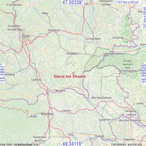
Stainz bei Straden GPS coordinates[2]
46° 49' 27.984" North, 15° 53' 31.992" East
| Map corner | latitude | longitude |
|---|---|---|
| Upper-left | 47.30339°, | 15.1891° |
| Center: | 46.82444°, | 15.89222° |
| Lower-right: | 46.34118°, | 16.59535° |
| Map W x H: | 107×107 km | = 66.5×66.5mi |
| max Lat: | 48.98333° ⇑90.8% North |
| Stainz bei Straden: | 46.82444° |
| min Lat: | ⇓9.2% South 46.48841° |
| min Long | Stainz bei Stra | max Long |
| 9.57802° | 15.89222° | 17.1° |
| W 77%⇐ | ⇒23% E |
Elevation
Elevation of Stainz bei Straden is 251 m = 823 ft, and this is 254.5 m = 835 ft below average elevation for this country.
| Max E: |
2140 m = 7021 ft | 84.2% |
| Avg. | 505.5 m = 1658 ft | |
| Stainz bei Straden | 251 m = 823 ft | |
Min E: |
118 m = 387 ft | 15.8% |
See also: Austria elevation on elevation.city.
Geographical zone
Stainz bei Straden is located in North temperate zone (between Tropic of Cancer and the Arctic Circle). Distance of this North polar circle is 2194.8 km =1363.8 mi to North.| Distance of | km | miles | from Stainz bei Straden |
|---|---|---|---|
| North Pole | 4800.7 | 2983 | to North |
| Arctic Circle | 2194.8 | 1363.8 | to North |
| Tropic Cancer | 2600.5 | 1615.9 | to South |
| Equator | 5206.4 | 3235.1 | to South |


Nearby cities:
15 places around Stainz bei Straden: (largest is in red/bold)
• Bad Gleichenberg
5.8 km =3.6 mi,  12°
12°
• Bairisch Kölldorf
5.6 km =3.5 mi,  33°
33°
• Dietersdorf am Gnasbach
6.4 km =4 mi,  254°
254°
• Gleichenberg Dorf
6.6 km =4.1 mi, 5°
• Grabersdorf
5.5 km =3.4 mi,  291°
291°
• Hof bei Straden
4.1 km =2.5 mi,  130°
130°
• Krusdorf
2.9 km =1.8 mi,  304°
304°
• Merkendorf
3.8 km =2.4 mi, 13°
• Poppendorf
4.5 km =2.8 mi,  322°
322°
• Raning
6.4 km =4 mi, 296°
• Sankt Anna am Aigen
6.1 km =3.8 mi,  82°
82°
• Straden
2.5 km =1.6 mi,  227°
227°
• Tieschen
5.7 km =3.5 mi,  138°
138°
• Trautmannsdorf in Oststeiermark
5.7 km =3.5 mi,  354°
354°
• Trössing
5.8 km =3.6 mi,  261°
261°
Sources, notices
• [Note1] Compared only with cities in Austria existing in our database
• [Src1] Map data: © OpenStreetMap contributors (CC-BY-SA)
• [Src2] Other city data from geonames.org with taken over terms of usage.
• [Src3] Geographical zone / Annual Mean Temperature by Robert A. Rohde @ Wikipedia
