Seefeld in Tirol geodata
Seefeld in Tirol (Tyrol) is a seat of a third-order administrative division; located in Austria in Europe/Vienna (GMT+2) time zone. With population of 3,440 people, there are 318 cities with bigger population in this country. Compared to other cities in Austria, 63.6% of cities are located further ↑North; 93.1% of cities are located further →East and 97.8% of cities have lower elevation than Seefeld in Tirol. Note1
Administrative division(s):
- Level 1: Tyrol
- Level 2: Politischer Bezirk Innsbruck Land
- Level 3: Seefeld in Tirol


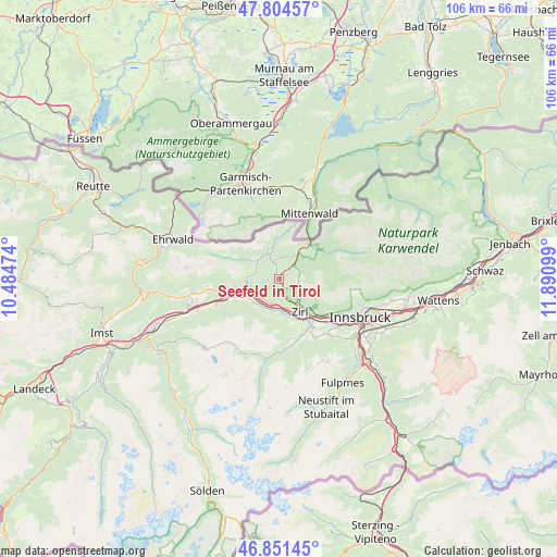
Seefeld in Tirol GPS coordinates[2]
47° 19' 48.576" North, 11° 11' 16.296" East
| Map corner | latitude | longitude |
|---|---|---|
| Upper-left | 47.80457°, | 10.48474° |
| Center: | 47.33016°, | 11.18786° |
| Lower-right: | 46.85145°, | 11.89099° |
| Map W x H: | 106×106 km | = 65.9×65.9mi |
| max Lat: | 48.98333° ⇑63.6% North |
| Seefeld in Tirol: | 47.33016° |
| min Lat: | ⇓36.4% South 46.48841° |
| min Long | Seefeld in Tiro | max Long |
| 9.57802° | 11.18786° | 17.1° |
| W 6.9%⇐ | ⇒93.1% E |
Elevation
Elevation of Seefeld in Tirol is 1178 m = 3865 ft, and this is 672.5 m = 2206 ft above average elevation for this country.
| Max E: |
2140 m = 7021 ft | 2.2% |
| Seefeld in Tirol | 1178 m 3865 ft | |
| Avg. | 505.5 m = 1658 ft | |
Min E: |
118 m = 387 ft | 97.8% |
See also: Austria elevation on elevation.city.
Geographical zone
Seefeld in Tirol is located in North temperate zone (between Tropic of Cancer and the Arctic Circle). Distance of this North polar circle is 2138.6 km =1328.9 mi to North.| Distance of | km | miles | from Seefeld in Tirol |
|---|---|---|---|
| North Pole | 4744.4 | 2948 | to North |
| Arctic Circle | 2138.6 | 1328.9 | to North |
| Tropic Cancer | 2656.7 | 1650.8 | to South |
| Equator | 5262.6 | 3270 | to South |


Nearby cities:
15 places around Seefeld in Tirol: (largest is in red/bold)
• Flaurling
6.5 km =4 mi,  228°
228°
• Hatting
5.9 km =3.7 mi,  194°
194°
• Inzing
6.3 km =3.9 mi,  173°
173°
• Leutasch
5.4 km =3.4 mi,  322°
322°
• Oberhofen im Inntal
8.6 km =5.3 mi,  246°
246°
• Oberperfuss
10.5 km =6.5 mi,  154°
154°
• Pettnau
4.7 km =2.9 mi,  206°
206°
• Pfaffenhofen
8.6 km =5.3 mi, 246°
• Polling in Tirol
5.9 km =3.7 mi, 208°
• Ranggen
8.3 km =5.2 mi, 167°
• Reith bei Seefeld
3.5 km =2.2 mi,  164°
164°
• Scharnitz
8.7 km =5.4 mi,  41°
41°
• Telfs
9.4 km =5.8 mi, 254°
• Unterperfuss
8.5 km =5.3 mi, 146°
• Zirl
7.4 km =4.6 mi, 147°
In other languages:
- In German: Seefeld
- In Russian: Зеефельд (Тироль), Зефельд-ин-Тироль
- In Chinese: 蒂罗尔州塞弗尔德
Sources, notices
• [Note1] Compared only with cities in Austria existing in our database
• [Src1] Map data: © OpenStreetMap contributors (CC-BY-SA)
• [Src2] Other city data from geonames.org with taken over terms of usage.
• [Src3] Geographical zone / Annual Mean Temperature by Robert A. Rohde @ Wikipedia
