Sattledt geodata
Sattledt (Upper Austria) is a seat of a third-order administrative division; located in Austria in Europe/Vienna (GMT+2) time zone. With population of 1,255 people, there are 1003 cities with bigger population in this country. Compared to other cities in Austria, 71% of cities are located further ↓South; 63.7% of cities are located further →East and 58.8% of cities have higher elevation than Sattledt. Note1


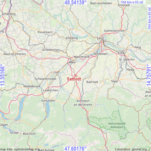
Sattledt GPS coordinates[2]
48° 4' 25.392" North, 14° 3' 17.208" East
| Map corner | latitude | longitude |
|---|---|---|
| Upper-left | 48.54139°, | 13.35166° |
| Center: | 48.07372°, | 14.05478° |
| Lower-right: | 47.60176°, | 14.75791° |
| Map W x H: | 104.5×104.5 km | = 64.9×64.9mi |
| max Lat: | 48.98333° ⇑29% North |
| Sattledt: | 48.07372° |
| min Lat: | ⇓71% South 46.48841° |
| min Long | Sattledt | max Long |
| 9.57802° | 14.05478° | 17.1° |
| W 36.3%⇐ | ⇒63.7% E |
Elevation
Elevation of Sattledt is 393 m = 1289 ft, and this is 112.5 m = 369 ft below average elevation for this country.
| Max E: |
2140 m = 7021 ft | 58.8% |
| Avg. | 505.5 m = 1658 ft | |
| Sattledt | 393 m = 1289 ft | |
Min E: |
118 m = 387 ft | 41.2% |
See also: Austria elevation on elevation.city.
Geographical zone
Sattledt is located in North temperate zone (between Tropic of Cancer and the Arctic Circle). Distance of this North polar circle is 2055.9 km =1277.5 mi to North.| Distance of | km | miles | from Sattledt |
|---|---|---|---|
| North Pole | 4661.8 | 2896.7 | to North |
| Arctic Circle | 2055.9 | 1277.5 | to North |
| Tropic Cancer | 2739.4 | 1702.2 | to South |
| Equator | 5345.3 | 3321.4 | to South |


Nearby cities:
15 places around Sattledt: (largest is in red/bold)
• Bernardin
10.2 km =6.3 mi,  340°
340°
• Brandln
9.1 km =5.7 mi,  330°
330°
• Eberstalzell
6.3 km =3.9 mi,  238°
238°
• Eggendorf im Traunkreis
9.2 km =5.7 mi,  46°
46°
• Gunskirchen
10.2 km =6.3 mi,  310°
310°
• Hochpoint
9.8 km =6.1 mi,  352°
352°
• Kremsmünster
6 km =3.7 mi,  112°
112°
• Lichtenegg
9.4 km =5.8 mi, 334°
• Ried im Traunkreis
5.5 km =3.4 mi,  164°
164°
• Schleissheim
9.8 km =6.1 mi,  8°
8°
• Sipbachzell
4.9 km =3 mi,  57°
57°
• Steinerkirchen an der Traun
7.2 km =4.5 mi,  274°
274°
• Steinhaus
5.4 km =3.4 mi, 330°
• Thalheim bei Wels
8.6 km =5.3 mi, 349°
• Wipfing
5.9 km =3.7 mi, 240°
Sources, notices
• [Note1] Compared only with cities in Austria existing in our database
• [Src1] Map data: © OpenStreetMap contributors (CC-BY-SA)
• [Src2] Other city data from geonames.org with taken over terms of usage.
• [Src3] Geographical zone / Annual Mean Temperature by Robert A. Rohde @ Wikipedia
