Sammersdorf geodata
Sammersdorf (Upper Austria) is a populated place; located in Austria in Europe/Vienna (GMT+2) time zone. With population of 1,005 people, there are 1285 cities with bigger population in this country. Compared to other cities in Austria, 77.7% of cities are located further ↓South; 61.4% of cities are located further →East and 77% of cities have higher elevation than Sammersdorf. Note1
Administrative division(s):
- Level 1: Upper Austria
- Level 2: Politischer Bezirk Linz-Land
- Level 3: Pucking


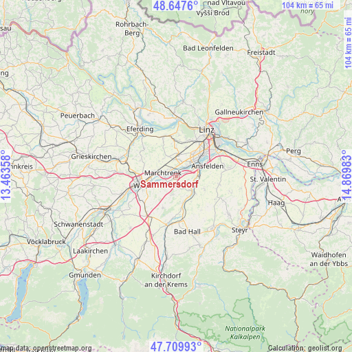
Sammersdorf GPS coordinates[2]
48° 10' 51.276" North, 14° 10' 0.12" East
| Map corner | latitude | longitude |
|---|---|---|
| Upper-left | 48.6476°, | 13.46358° |
| Center: | 48.18091°, | 14.1667° |
| Lower-right: | 47.70993°, | 14.86983° |
| Map W x H: | 104.3×104.3 km | = 64.8×64.8mi |
| max Lat: | 48.98333° ⇑22.3% North |
| Sammersdorf: | 48.18091° |
| min Lat: | ⇓77.7% South 46.48841° |
| min Long | Sammersdorf | max Long |
| 9.57802° | 14.1667° | 17.1° |
| W 38.6%⇐ | ⇒61.4% E |
Elevation
Elevation of Sammersdorf is 289 m = 948 ft, and this is 216.5 m = 710 ft below average elevation for this country.
| Max E: |
2140 m = 7021 ft | 77% |
| Avg. | 505.5 m = 1658 ft | |
| Sammersdorf | 289 m = 948 ft | |
Min E: |
118 m = 387 ft | 23% |
See also: Austria elevation on elevation.city.
Geographical zone
Sammersdorf is located in North temperate zone (between Tropic of Cancer and the Arctic Circle). Distance of this North polar circle is 2044 km =1270.1 mi to North.| Distance of | km | miles | from Sammersdorf |
|---|---|---|---|
| North Pole | 4649.8 | 2889.3 | to North |
| Arctic Circle | 2044 | 1270.1 | to North |
| Tropic Cancer | 2751.3 | 1709.6 | to South |
| Equator | 5357.2 | 3328.8 | to South |


Nearby cities:
15 places around Sammersdorf: (largest is in red/bold)
• Allhaming
3.2 km =2 mi,  175°
175°
• Au an der Traun
4 km =2.5 mi,  268°
268°
• Bergern
4.4 km =2.7 mi,  250°
250°
• Eggendorf im Traunkreis
5.8 km =3.6 mi,  196°
196°
• Hörsching
5.1 km =3.2 mi,  9°
9°
• Marchtrenk
4.1 km =2.5 mi,  288°
288°
• Mitterperwend
6.1 km =3.8 mi,  296°
296°
• Neubau
4.7 km =2.9 mi,  24°
24°
• Nöstlbach
6.1 km =3.8 mi,  105°
105°
• Oedt
4.8 km =3 mi,  41°
41°
• Pucking
1.8 km =1.1 mi,  61°
61°
• Rutzing
3 km =1.9 mi,  27°
27°
• Unterhart
5.8 km =3.6 mi, 285°
• Weisskirchen an der Traun
3.8 km =2.4 mi,  236°
236°
• Öhndorf
3.5 km =2.2 mi, 30°
Sources, notices
• [Note1] Compared only with cities in Austria existing in our database
• [Src1] Map data: © OpenStreetMap contributors (CC-BY-SA)
• [Src2] Other city data from geonames.org with taken over terms of usage.
• [Src3] Geographical zone / Annual Mean Temperature by Robert A. Rohde @ Wikipedia
