Bergern geodata
Bergern (Upper Austria) is a populated place; located in Austria in Europe/Vienna (GMT+2) time zone. With population of 1,214 people, there are 1034 cities with bigger population in this country. Compared to other cities in Austria, 77.1% of cities are located further ↓South; 62.5% of cities are located further →East and 75.8% of cities have higher elevation than Bergern. Note1
Administrative division(s):
- Level 1: Upper Austria
- Level 2: Wels-Land
- Level 3: Weißkirchen an der Traun


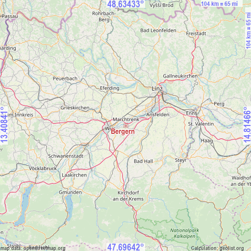
Bergern GPS coordinates[2]
48° 10' 3.072" North, 14° 6' 41.508" East
| Map corner | latitude | longitude |
|---|---|---|
| Upper-left | 48.63433°, | 13.40841° |
| Center: | 48.16752°, | 14.11153° |
| Lower-right: | 47.69642°, | 14.81466° |
| Map W x H: | 104.3×104.3 km | = 64.8×64.8mi |
| max Lat: | 48.98333° ⇑22.9% North |
| Bergern: | 48.16752° |
| min Lat: | ⇓77.1% South 46.48841° |
| min Long | Bergern | max Long |
| 9.57802° | 14.11153° | 17.1° |
| W 37.5%⇐ | ⇒62.5% E |
Elevation
Elevation of Bergern is 298 m = 978 ft, and this is 207.5 m = 681 ft below average elevation for this country.
| Max E: |
2140 m = 7021 ft | 75.8% |
| Avg. | 505.5 m = 1658 ft | |
| Bergern | 298 m = 978 ft | |
Min E: |
118 m = 387 ft | 24.2% |
See also: Austria elevation on elevation.city.
Geographical zone
Bergern is located in North temperate zone (between Tropic of Cancer and the Arctic Circle). Distance of this North polar circle is 2045.4 km =1271 mi to North.| Distance of | km | miles | from Bergern |
|---|---|---|---|
| North Pole | 4651.3 | 2890.2 | to North |
| Arctic Circle | 2045.4 | 1271 | to North |
| Tropic Cancer | 2749.8 | 1708.6 | to South |
| Equator | 5355.7 | 3327.9 | to South |


Nearby cities:
15 places around Bergern: (largest is in red/bold)
• Allhaming
4.7 km =2.9 mi,  111°
111°
• Au an der Traun
1.4 km =0.9 mi,  2°
2°
• Dickerldorf
4.2 km =2.6 mi,  284°
284°
• Eggendorf im Traunkreis
4.8 km =3 mi,  149°
149°
• Haidl
4.4 km =2.7 mi, 277°
• Hochpoint
5.5 km =3.4 mi,  262°
262°
• Marchtrenk
2.8 km =1.7 mi, 3°
• Mitterperwend
4.5 km =2.8 mi,  341°
341°
• Oberhart
4.9 km =3 mi,  291°
291°
• Sammersdorf
4.4 km =2.7 mi,  70°
70°
• Schafwiesen
3.3 km =2.1 mi,  268°
268°
• Schleissheim
2.8 km =1.7 mi,  254°
254°
• Untereisenfeld
5.2 km =3.2 mi, 270°
• Unterhart
3.4 km =2.1 mi,  334°
334°
• Weisskirchen an der Traun
1.1 km =0.7 mi,  123°
123°
Sources, notices
• [Note1] Compared only with cities in Austria existing in our database
• [Src1] Map data: © OpenStreetMap contributors (CC-BY-SA)
• [Src2] Other city data from geonames.org with taken over terms of usage.
• [Src3] Geographical zone / Annual Mean Temperature by Robert A. Rohde @ Wikipedia
