Allhaming geodata
Allhaming (Upper Austria) is a seat of a third-order administrative division; located in Austria in Europe/Vienna (GMT+2) time zone. With population of 710 people, there are 1833 cities with bigger population in this country. Compared to other cities in Austria, 75.8% of cities are located further ↓South; 61.3% of cities are located further →East and 66.8% of cities have higher elevation than Allhaming. Note1
Administrative division(s):
- Level 1: Upper Austria
- Level 2: Politischer Bezirk Linz-Land
- Level 3: Allhaming


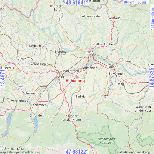
Allhaming GPS coordinates[2]
48° 9' 8.856" North, 14° 10' 12.792" East
| Map corner | latitude | longitude |
|---|---|---|
| Upper-left | 48.61941°, | 13.4671° |
| Center: | 48.15246°, | 14.17022° |
| Lower-right: | 47.68122°, | 14.87335° |
| Map W x H: | 104.3×104.3 km | = 64.8×64.8mi |
| max Lat: | 48.98333° ⇑24.2% North |
| Allhaming: | 48.15246° |
| min Lat: | ⇓75.8% South 46.48841° |
| min Long | Allhaming | max Long |
| 9.57802° | 14.17022° | 17.1° |
| W 38.7%⇐ | ⇒61.3% E |
Elevation
Elevation of Allhaming is 343 m = 1125 ft, and this is 162.5 m = 533 ft below average elevation for this country.
| Max E: |
2140 m = 7021 ft | 66.8% |
| Avg. | 505.5 m = 1658 ft | |
| Allhaming | 343 m = 1125 ft | |
Min E: |
118 m = 387 ft | 33.2% |
See also: Austria elevation on elevation.city.
Geographical zone
Allhaming is located in North temperate zone (between Tropic of Cancer and the Arctic Circle). Distance of this North polar circle is 2047.1 km =1272 mi to North.| Distance of | km | miles | from Allhaming |
|---|---|---|---|
| North Pole | 4653 | 2891.2 | to North |
| Arctic Circle | 2047.1 | 1272 | to North |
| Tropic Cancer | 2748.1 | 1707.6 | to South |
| Equator | 5354.1 | 3326.9 | to South |


Nearby cities:
15 places around Allhaming: (largest is in red/bold)
• Au an der Traun
5.3 km =3.3 mi,  305°
305°
• Bergern
4.7 km =2.9 mi,  291°
291°
• Eggendorf im Traunkreis
3.1 km =1.9 mi,  218°
218°
• Kematen an der Krems
4.9 km =3 mi,  158°
158°
• Marchtrenk
6.1 km =3.8 mi,  317°
317°
• Neuhofen an der Krems
4.5 km =2.8 mi,  109°
109°
• Nöstlbach
5.8 km =3.6 mi,  74°
74°
• Piberbach
5.9 km =3.7 mi,  134°
134°
• Pucking
4.3 km =2.7 mi,  18°
18°
• Rutzing
6 km =3.7 mi,  10°
10°
• Sammersdorf
3.2 km =2 mi,  355°
355°
• Schleissheim
7.1 km =4.4 mi,  277°
277°
• Weifersdorf
5.5 km =3.4 mi,  120°
120°
• Weisskirchen an der Traun
3.6 km =2.2 mi, 287°
• Öhndorf
6.4 km =4 mi, 13°
Sources, notices
• [Note1] Compared only with cities in Austria existing in our database
• [Src1] Map data: © OpenStreetMap contributors (CC-BY-SA)
• [Src2] Other city data from geonames.org with taken over terms of usage.
• [Src3] Geographical zone / Annual Mean Temperature by Robert A. Rohde @ Wikipedia
