Riezlern geodata
Riezlern (Vorarlberg) is a populated place; located in Austria in Europe/Vienna (GMT+2) time zone. With population of 1,998 people, there are 616 cities with bigger population in this country. Compared to other cities in Austria, 62.1% of cities are located further ↑North; 96.5% of cities are located further →East and 96.4% of cities have lower elevation than Riezlern. Note1
Administrative division(s):
- Level 1: Vorarlberg
- Level 2: Politischer Bezirk Bregenz
- Level 3: Mittelberg


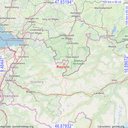
Riezlern GPS coordinates[2]
47° 21' 28.008" North, 10° 11' 15.324" East
| Map corner | latitude | longitude |
|---|---|---|
| Upper-left | 47.83194°, | 9.48447° |
| Center: | 47.35778°, | 10.18759° |
| Lower-right: | 46.87932°, | 10.89072° |
| Map W x H: | 105.9×105.9 km | = 65.8×65.8mi |
| max Lat: | 48.98333° ⇑62.1% North |
| Riezlern: | 47.35778° |
| min Lat: | ⇓37.9% South 46.48841° |
| min Long | Riezlern | max Long |
| 9.57802° | 10.18759° | 17.1° |
| W 3.5%⇐ | ⇒96.5% E |
Elevation
Elevation of Riezlern is 1092 m = 3583 ft, and this is 586.5 m = 1924 ft above average elevation for this country.
| Max E: |
2140 m = 7021 ft | 3.6% |
| Riezlern | 1092 m 3583 ft | |
| Avg. | 505.5 m = 1658 ft | |
Min E: |
118 m = 387 ft | 96.4% |
See also: Austria elevation on elevation.city.
Geographical zone
Riezlern is located in North temperate zone (between Tropic of Cancer and the Arctic Circle). Distance of this North polar circle is 2135.5 km =1326.9 mi to North.| Distance of | km | miles | from Riezlern |
|---|---|---|---|
| North Pole | 4741.4 | 2946.2 | to North |
| Arctic Circle | 2135.5 | 1326.9 | to North |
| Tropic Cancer | 2659.8 | 1652.7 | to South |
| Equator | 5265.7 | 3272 | to South |


Nearby cities:
15 places around Riezlern: (largest is in red/bold)
• Au
16.1 km =10 mi,  255°
255°
• Bizau
19.6 km =12.2 mi,  273°
273°
• Elbigenalp
20.2 km =12.6 mi,  111°
111°
• Hirschegg
1.6 km =1 mi,  228°
228°
• Hittisau
20.4 km =12.7 mi,  302°
302°
• Holzgau
16 km =9.9 mi,  132°
132°
• Lech
17 km =10.6 mi,  191°
191°
• Mittelberg
1.4 km =0.9 mi,  238°
238°
• Rehmen
14.9 km =9.3 mi,  254°
254°
• Schnepfau
18.3 km =11.4 mi, 268°
• Schoppernau
13.9 km =8.6 mi, 248°
• Schröcken
13.3 km =8.3 mi,  212°
212°
• Sibratsgfäll
13.6 km =8.5 mi, 304°
• Steeg
15 km =9.3 mi,  147°
147°
• Warth
12 km =7.5 mi,  181°
181°
Sources, notices
• [Note1] Compared only with cities in Austria existing in our database
• [Src1] Map data: © OpenStreetMap contributors (CC-BY-SA)
• [Src2] Other city data from geonames.org with taken over terms of usage.
• [Src3] Geographical zone / Annual Mean Temperature by Robert A. Rohde @ Wikipedia
