Rehmen geodata
Rehmen (Vorarlberg) is a populated place; located in Austria in Europe/Vienna (GMT+2) time zone. With population of 666 people, there are 1947 cities with bigger population in this country. Compared to other cities in Austria, 63.9% of cities are located further ↑North; 97% of cities are located further →East and 87.1% of cities have lower elevation than Rehmen. Note1


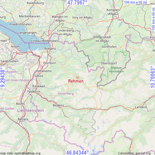
Rehmen GPS coordinates[2]
47° 19' 19.992" North, 9° 59' 51" East
| Map corner | latitude | longitude |
|---|---|---|
| Upper-left | 47.7967°, | 9.29438° |
| Center: | 47.32222°, | 9.9975° |
| Lower-right: | 46.84344°, | 10.70063° |
| Map W x H: | 106×106 km | = 65.9×65.9mi |
| max Lat: | 48.98333° ⇑63.9% North |
| Rehmen: | 47.32222° |
| min Lat: | ⇓36.1% South 46.48841° |
| min Long | Rehmen | max Long |
| 9.57802° | 9.9975° | 17.1° |
| W 3%⇐ | ⇒97% E |
Elevation
Elevation of Rehmen is 830 m = 2723 ft, and this is 324.5 m = 1065 ft above average elevation for this country.
| Max E: |
2140 m = 7021 ft | 12.9% |
| Rehmen | 830 m 2723 ft | |
| Avg. | 505.5 m = 1658 ft | |
Min E: |
118 m = 387 ft | 87.1% |
See also: Austria elevation on elevation.city.
Geographical zone
Rehmen is located in North temperate zone (between Tropic of Cancer and the Arctic Circle). Distance of this North polar circle is 2139.4 km =1329.4 mi to North.| Distance of | km | miles | from Rehmen |
|---|---|---|---|
| North Pole | 4745.3 | 2948.6 | to North |
| Arctic Circle | 2139.4 | 1329.4 | to North |
| Tropic Cancer | 2655.8 | 1650.2 | to South |
| Equator | 5261.7 | 3269.5 | to South |


Nearby cities:
15 places around Rehmen: (largest is in red/bold)
• Andelsbuch
12.7 km =7.9 mi,  321°
321°
• Au
1.3 km =0.8 mi,  267°
267°
• Bezau
10 km =6.2 mi,  313°
313°
• Bizau
7.4 km =4.6 mi, 315°
• Damüls
9.2 km =5.7 mi,  239°
239°
• Großdorf
13.8 km =8.6 mi,  333°
333°
• Hirschegg
13.4 km =8.3 mi,  77°
77°
• Mellau
9.3 km =5.8 mi,  289°
289°
• Mittelberg
13.5 km =8.4 mi, 76°
• Reuthe
9.5 km =5.9 mi, 305°
• Schnepfau
5.2 km =3.2 mi, 310°
• Schoppernau
1.8 km =1.1 mi,  128°
128°
• Schröcken
10.1 km =6.3 mi,  135°
135°
• Sibratsgfäll
12 km =7.5 mi,  14°
14°
• Sonntag
12 km =7.5 mi,  219°
219°
Sources, notices
• [Note1] Compared only with cities in Austria existing in our database
• [Src1] Map data: © OpenStreetMap contributors (CC-BY-SA)
• [Src2] Other city data from geonames.org with taken over terms of usage.
• [Src3] Geographical zone / Annual Mean Temperature by Robert A. Rohde @ Wikipedia
