Redlham geodata
Redlham (Upper Austria) is a seat of a third-order administrative division; located in Austria in Europe/Vienna (GMT+2) time zone. With population of 389 people, there are 2632 cities with bigger population in this country. Compared to other cities in Austria, 68.1% of cities are located further ↓South; 70.5% of cities are located further →East and 57.5% of cities have higher elevation than Redlham. Note1
Administrative division(s):
- Level 1: Upper Austria
- Level 2: Politischer Bezirk Vöcklabruck
- Level 3: Redlham


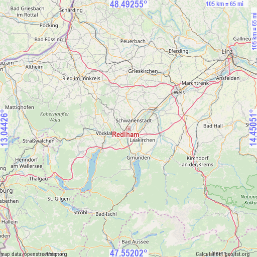
Redlham GPS coordinates[2]
48° 1' 27.948" North, 13° 44' 50.568" East
| Map corner | latitude | longitude |
|---|---|---|
| Upper-left | 48.49255°, | 13.04426° |
| Center: | 48.02443°, | 13.74738° |
| Lower-right: | 47.55202°, | 14.45051° |
| Map W x H: | 104.6×104.6 km | = 65×65mi |
| max Lat: | 48.98333° ⇑31.9% North |
| Redlham: | 48.02443° |
| min Lat: | ⇓68.1% South 46.48841° |
| min Long | Redlham | max Long |
| 9.57802° | 13.74738° | 17.1° |
| W 29.5%⇐ | ⇒70.5% E |
Elevation
Elevation of Redlham is 401 m = 1316 ft, and this is 104.5 m = 343 ft below average elevation for this country.
| Max E: |
2140 m = 7021 ft | 57.5% |
| Avg. | 505.5 m = 1658 ft | |
| Redlham | 401 m = 1316 ft | |
Min E: |
118 m = 387 ft | 42.5% |
See also: Austria elevation on elevation.city.
Geographical zone
Redlham is located in North temperate zone (between Tropic of Cancer and the Arctic Circle). Distance of this North polar circle is 2061.4 km =1280.9 mi to North.| Distance of | km | miles | from Redlham |
|---|---|---|---|
| North Pole | 4667.2 | 2900.1 | to North |
| Arctic Circle | 2061.4 | 1280.9 | to North |
| Tropic Cancer | 2733.9 | 1698.8 | to South |
| Equator | 5339.8 | 3318 | to South |


Nearby cities:
15 places around Redlham: (largest is in red/bold)
• Attnang
2.4 km =1.5 mi,  249°
249°
• Attnang-Puchheim
2.9 km =1.8 mi,  231°
231°
• Desselbrunn
1.7 km =1.1 mi,  101°
101°
• Kaufing
5.2 km =3.2 mi,  48°
48°
• Niederstraß
1.8 km =1.1 mi, 228°
• Oberndorf bei Schwanenstadt
3.5 km =2.2 mi,  11°
11°
• Oberstraß
3.6 km =2.2 mi, 230°
• Pitzenberg
5.7 km =3.5 mi,  342°
342°
• Preising
4.4 km =2.7 mi,  222°
222°
• Puchheim
3.5 km =2.2 mi, 220°
• Pühret
2.2 km =1.4 mi,  302°
302°
• Roitham
5.5 km =3.4 mi,  90°
90°
• Rutzenham
4.6 km =2.9 mi,  332°
332°
• Rüstorf
3.8 km =2.4 mi,  56°
56°
• Schwanenstadt
4 km =2.5 mi,  30°
30°
Sources, notices
• [Note1] Compared only with cities in Austria existing in our database
• [Src1] Map data: © OpenStreetMap contributors (CC-BY-SA)
• [Src2] Other city data from geonames.org with taken over terms of usage.
• [Src3] Geographical zone / Annual Mean Temperature by Robert A. Rohde @ Wikipedia
