Preising geodata
Preising (Upper Austria) is a populated place; located in Austria in Europe/Vienna (GMT+2) time zone. With population of 802 people, there are 1612 cities with bigger population in this country. Compared to other cities in Austria, 65.8% of cities are located further ↓South; 71.4% of cities are located further →East and 56.8% of cities have higher elevation than Preising. Note1
Administrative division(s):
- Level 1: Upper Austria
- Level 2: Politischer Bezirk Vöcklabruck
- Level 3: Regau


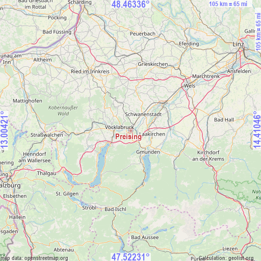
Preising GPS coordinates[2]
47° 59' 41.928" North, 13° 42' 26.388" East
| Map corner | latitude | longitude |
|---|---|---|
| Upper-left | 48.46336°, | 13.00421° |
| Center: | 47.99498°, | 13.70733° |
| Lower-right: | 47.52231°, | 14.41046° |
| Map W x H: | 104.6×104.6 km | = 65×65mi |
| max Lat: | 48.98333° ⇑34.2% North |
| Preising: | 47.99498° |
| min Lat: | ⇓65.8% South 46.48841° |
| min Long | Preising | max Long |
| 9.57802° | 13.70733° | 17.1° |
| W 28.6%⇐ | ⇒71.4% E |
Elevation
Elevation of Preising is 406 m = 1332 ft, and this is 99.5 m = 326 ft below average elevation for this country.
| Max E: |
2140 m = 7021 ft | 56.8% |
| Avg. | 505.5 m = 1658 ft | |
| Preising | 406 m = 1332 ft | |
Min E: |
118 m = 387 ft | 43.2% |
See also: Austria elevation on elevation.city.
Geographical zone
Preising is located in North temperate zone (between Tropic of Cancer and the Arctic Circle). Distance of this North polar circle is 2064.6 km =1282.9 mi to North.| Distance of | km | miles | from Preising |
|---|---|---|---|
| North Pole | 4670.5 | 2902.1 | to North |
| Arctic Circle | 2064.6 | 1282.9 | to North |
| Tropic Cancer | 2730.6 | 1696.7 | to South |
| Equator | 5336.5 | 3315.9 | to South |


Nearby cities:
15 places around Preising: (largest is in red/bold)
• Attnang
2.5 km =1.6 mi,  16°
16°
• Attnang-Puchheim
1.6 km =1 mi,  25°
25°
• Dörfl
4.4 km =2.7 mi,  296°
296°
• Lixlau
3.4 km =2.1 mi,  269°
269°
• Niederstraß
2.7 km =1.7 mi,  38°
38°
• Oberstraß
1 km =0.6 mi,  10°
10°
• Puchheim
0.9 km =0.6 mi,  51°
51°
• Pühret
4.6 km =2.9 mi, 14°
• Redlham
4.4 km =2.7 mi, 42°
• Regau
1.5 km =0.9 mi,  251°
251°
• Rutzenmoos
2.4 km =1.5 mi,  178°
178°
• Schalchham
2.7 km =1.7 mi,  277°
277°
• Schöndorf
3.7 km =2.3 mi, 281°
• Vöcklabruck
3.9 km =2.4 mi, 282°
• Wagrain
2.9 km =1.8 mi,  292°
292°
Sources, notices
• [Note1] Compared only with cities in Austria existing in our database
• [Src1] Map data: © OpenStreetMap contributors (CC-BY-SA)
• [Src2] Other city data from geonames.org with taken over terms of usage.
• [Src3] Geographical zone / Annual Mean Temperature by Robert A. Rohde @ Wikipedia
