Roitham geodata
Roitham (Upper Austria) is a seat of a third-order administrative division; located in Austria in Europe/Vienna (GMT+2) time zone. With population of 1,017 people, there are 1261 cities with bigger population in this country. Compared to other cities in Austria, 68.1% of cities are located further ↓South; 68.6% of cities are located further →East and 54.9% of cities have higher elevation than Roitham. Note1
Administrative division(s):
- Level 1: Upper Austria
- Level 2: Politischer Bezirk Gmunden
- Level 3: Roitham


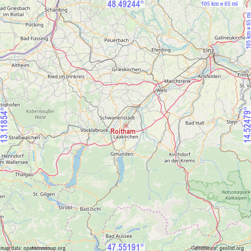
Roitham GPS coordinates[2]
48° 1' 27.552" North, 13° 49' 17.976" East
| Map corner | latitude | longitude |
|---|---|---|
| Upper-left | 48.49244°, | 13.11854° |
| Center: | 48.02432°, | 13.82166° |
| Lower-right: | 47.55191°, | 14.52479° |
| Map W x H: | 104.6×104.6 km | = 65×65mi |
| max Lat: | 48.98333° ⇑31.9% North |
| Roitham: | 48.02432° |
| min Lat: | ⇓68.1% South 46.48841° |
| min Long | Roitham | max Long |
| 9.57802° | 13.82166° | 17.1° |
| W 31.4%⇐ | ⇒68.6% E |
Elevation
Elevation of Roitham is 421 m = 1381 ft, and this is 84.5 m = 277 ft below average elevation for this country.
| Max E: |
2140 m = 7021 ft | 54.9% |
| Avg. | 505.5 m = 1658 ft | |
| Roitham | 421 m = 1381 ft | |
Min E: |
118 m = 387 ft | 45.1% |
See also: Austria elevation on elevation.city.
Geographical zone
Roitham is located in North temperate zone (between Tropic of Cancer and the Arctic Circle). Distance of this North polar circle is 2061.4 km =1280.9 mi to North.| Distance of | km | miles | from Roitham |
|---|---|---|---|
| North Pole | 4667.3 | 2900.1 | to North |
| Arctic Circle | 2061.4 | 1280.9 | to North |
| Tropic Cancer | 2733.9 | 1698.8 | to South |
| Equator | 5339.8 | 3318 | to South |


Nearby cities:
15 places around Roitham: (largest is in red/bold)
• Desselbrunn
3.8 km =2.4 mi,  265°
265°
• Kaufing
3.8 km =2.4 mi,  334°
334°
• Laakirchen
4.7 km =2.9 mi,  180°
180°
• Niederstraß
6.9 km =4.3 mi,  260°
260°
• Oberndorf bei Schwanenstadt
5.9 km =3.7 mi,  305°
305°
• Ohlsdorf
7.4 km =4.6 mi,  197°
197°
• Pühret
7.5 km =4.7 mi,  279°
279°
• Redlham
5.5 km =3.4 mi, 270°
• Rüstorf
3.2 km =2 mi, 311°
• Schlatt
5.8 km =3.6 mi,  335°
335°
• Schwanenstadt
4.9 km =3 mi, 314°
• Stadl-Hausruck
6.9 km =4.3 mi,  19°
19°
• Stadl-Paura
7.4 km =4.6 mi,  27°
27°
• Stadl-Traun
6.8 km =4.2 mi, 25°
• Wimsbach
7.5 km =4.7 mi,  51°
51°
Sources, notices
• [Note1] Compared only with cities in Austria existing in our database
• [Src1] Map data: © OpenStreetMap contributors (CC-BY-SA)
• [Src2] Other city data from geonames.org with taken over terms of usage.
• [Src3] Geographical zone / Annual Mean Temperature by Robert A. Rohde @ Wikipedia
