Rax geodata
Rax (Burgenland) is a populated place; located in Austria in Europe/Vienna (GMT+2) time zone. With population of 615 people, there are 2080 cities with bigger population in this country. Compared to other cities in Austria, 87.1% of cities are located further ↑North; 85% of cities are located further ←West and 87.4% of cities have higher elevation than Rax. Note1
Administrative division(s):
- Level 1: Burgenland
- Level 2: Politischer Bezirk Jennersdorf
- Level 3: Jennersdorf


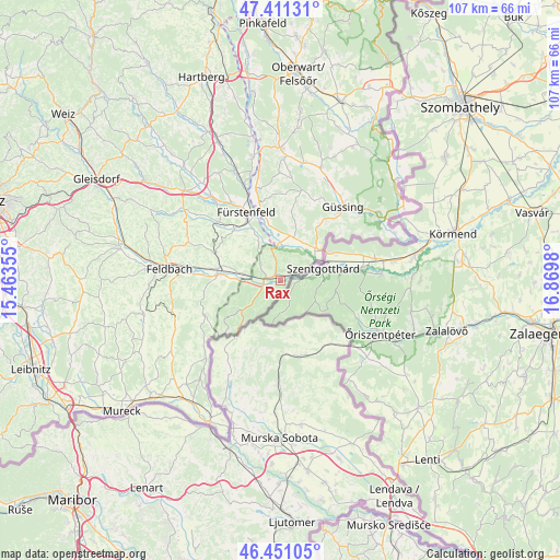
Rax GPS coordinates[2]
46° 55' 59.988" North, 16° 10' 0.012" East
| Map corner | latitude | longitude |
|---|---|---|
| Upper-left | 47.41131°, | 15.46355° |
| Center: | 46.93333°, | 16.16667° |
| Lower-right: | 46.45105°, | 16.8698° |
| Map W x H: | 106.8×106.8 km | = 66.4×66.4mi |
| max Lat: | 48.98333° ⇑87.1% North |
| Rax: | 46.93333° |
| min Lat: | ⇓12.9% South 46.48841° |
| min Long | Rax | max Long |
| 9.57802° | 16.16667° | 17.1° |
| W 85%⇐ | ⇒15% E |
Elevation
Elevation of Rax is 233 m = 764 ft, and this is 272.5 m = 894 ft below average elevation for this country.
| Max E: |
2140 m = 7021 ft | 87.4% |
| Avg. | 505.5 m = 1658 ft | |
| Rax | 233 m = 764 ft | |
Min E: |
118 m = 387 ft | 12.6% |
See also: Austria elevation on elevation.city.
Geographical zone
Rax is located in North temperate zone (between Tropic of Cancer and the Arctic Circle). Distance of this North polar circle is 2182.7 km =1356.3 mi to North.| Distance of | km | miles | from Rax |
|---|---|---|---|
| North Pole | 4788.6 | 2975.5 | to North |
| Arctic Circle | 2182.7 | 1356.3 | to North |
| Tropic Cancer | 2612.6 | 1623.4 | to South |
| Equator | 5218.5 | 3242.6 | to South |


Nearby cities:
15 places around Rax: (largest is in red/bold)
• Brunn
11.5 km =7.1 mi,  279°
279°
• Dietersdorf bei Fürstenfeld
11.1 km =6.9 mi,  332°
332°
• Eltendorf
8.8 km =5.5 mi,  17°
17°
• Grieselstein
4.1 km =2.5 mi,  301°
301°
• Heiligenkreuz im Lafnitztal
9.5 km =5.9 mi,  49°
49°
• Hohenbrugg an der Raab
7.5 km =4.7 mi, 283°
• Jennersdorf
2 km =1.2 mi,  286°
286°
• Königsdorf
7.4 km =4.6 mi,  0°
0°
• Loipersdorf bei Fürstenfeld
9 km =5.6 mi, 325°
• Mogersdorf
5.3 km =3.3 mi,  70°
70°
• Mühlgraben
10.7 km =6.6 mi,  243°
243°
• Sankt Martin an der Raab
2.6 km =1.6 mi, 242°
• Stein
9.4 km =5.8 mi,  319°
319°
• Unterlamm
9.2 km =5.7 mi, 301°
• Weichselbaum
1.9 km =1.2 mi,  57°
57°
Sources, notices
• [Note1] Compared only with cities in Austria existing in our database
• [Src1] Map data: © OpenStreetMap contributors (CC-BY-SA)
• [Src2] Other city data from geonames.org with taken over terms of usage.
• [Src3] Geographical zone / Annual Mean Temperature by Robert A. Rohde @ Wikipedia
