Regau geodata
Regau (Upper Austria) is a seat of a third-order administrative division; located in Austria in Europe/Vienna (GMT+2) time zone. With population of 702 people, there are 1850 cities with bigger population in this country. Compared to other cities in Austria, 65.5% of cities are located further ↓South; 71.6% of cities are located further →East and 53.8% of cities have higher elevation than Regau. Note1
Administrative division(s):
- Level 1: Upper Austria
- Level 2: Politischer Bezirk Vöcklabruck
- Level 3: Regau


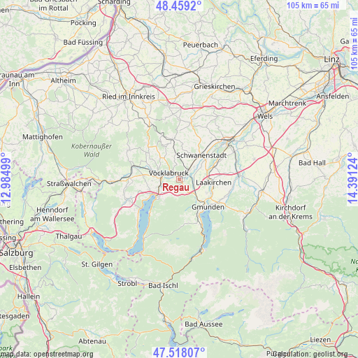
Regau GPS coordinates[2]
47° 59' 26.808" North, 13° 41' 17.196" East
| Map corner | latitude | longitude |
|---|---|---|
| Upper-left | 48.4592°, | 12.98499° |
| Center: | 47.99078°, | 13.68811° |
| Lower-right: | 47.51807°, | 14.39124° |
| Map W x H: | 104.6×104.6 km | = 65×65mi |
| max Lat: | 48.98333° ⇑34.5% North |
| Regau: | 47.99078° |
| min Lat: | ⇓65.5% South 46.48841° |
| min Long | Regau | max Long |
| 9.57802° | 13.68811° | 17.1° |
| W 28.4%⇐ | ⇒71.6% E |
Elevation
Elevation of Regau is 429 m = 1407 ft, and this is 76.5 m = 251 ft below average elevation for this country.
| Max E: |
2140 m = 7021 ft | 53.8% |
| Avg. | 505.5 m = 1658 ft | |
| Regau | 429 m = 1407 ft | |
Min E: |
118 m = 387 ft | 46.2% |
See also: Austria elevation on elevation.city.
Geographical zone
Regau is located in North temperate zone (between Tropic of Cancer and the Arctic Circle). Distance of this North polar circle is 2065.1 km =1283.2 mi to North.| Distance of | km | miles | from Regau |
|---|---|---|---|
| North Pole | 4671 | 2902.4 | to North |
| Arctic Circle | 2065.1 | 1283.2 | to North |
| Tropic Cancer | 2730.2 | 1696.5 | to South |
| Equator | 5336.1 | 3315.7 | to South |


Nearby cities:
15 places around Regau: (largest is in red/bold)
• Attnang
3.6 km =2.2 mi,  36°
36°
• Attnang-Puchheim
2.9 km =1.8 mi,  47°
47°
• Aurach am Hongar
4.5 km =2.8 mi,  194°
194°
• Dörfl
3.5 km =2.2 mi,  314°
314°
• Dürnau
3.3 km =2.1 mi,  282°
282°
• Lixlau
2 km =1.2 mi, 282°
• Niederstraß
4 km =2.5 mi, 50°
• Oberstraß
2.2 km =1.4 mi, 47°
• Preising
1.5 km =0.9 mi,  71°
71°
• Puchheim
2.4 km =1.5 mi,  64°
64°
• Rutzenmoos
2.4 km =1.5 mi,  141°
141°
• Schalchham
1.5 km =0.9 mi,  304°
304°
• Schöndorf
2.5 km =1.6 mi, 299°
• Vöcklabruck
2.7 km =1.7 mi, 299°
• Wagrain
2 km =1.2 mi,  322°
322°
Sources, notices
• [Note1] Compared only with cities in Austria existing in our database
• [Src1] Map data: © OpenStreetMap contributors (CC-BY-SA)
• [Src2] Other city data from geonames.org with taken over terms of usage.
• [Src3] Geographical zone / Annual Mean Temperature by Robert A. Rohde @ Wikipedia
